Villacastin - Eduardo Castellanos
Airport details
| Country | Spain |
| State | Castile and León |
| Region | LE |
| Airspace | Madrid Ctr |
| Municipality | Villacastín |
| Elevation | 3672ft (1119m) |
| Timezone | GMT +1 |
| Coordinates | 40.78389, -4.46278 |
| Magnetic var | |
| Type | land |
| Available since | X-Plane v10.40 |
| ICAO code | LEEV |
| IATA code | n/a |
| FAA code | n/a |
Communication
Nearby Points of Interest:
Our Lady of Cubillo
-Church of San Nicolás de Bari, Navas de San Antonio
-Church of Santo Tomás de Canterbury, Vegas de Matute
-Hermitage of San Miguel de Párraces
-Church of Santo Domingo, Ávila
-Royal Monastery of Santa Ana, Ávila
-Monastery of San Francisco, Ávila
-Monastery of the Encarnación, Ávila
-Casa de los Deanes
-Palacio de los Águila
-Ávila
-Archivo Histórico Provincial de Ávila
-Nuestra Señora de la Asunción Church (Paradinas, Spain)
-Church of San Juan Evangelista, La Losa
-Church of Saint John the Baptist, San Juan de la Encinilla
-Paraje Pintoresco del Pinar de Abantos y Zona de La Herrería
-Casita del Infante
-Palacio de Enrique IV, Segovia
-Seminario Conciliar de Segovia
-Biblioteca de la Academia de Artillería
-Monastery and Site of the Escurial, Madrid
-Aqueduct of Segovia
-Old Town of Segovia and its Aqueduct
-Museo de Segovia
-Monastery of Santa Cruz la Real, Segovia
Runway info
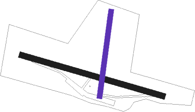
Runway 12 / 30  | ||
| length | 1402m (4600ft) | |
| bearing | 106° / 286° | |
| width | 56m (184ft) | |
| surface | grass | |
| displ threshold | 183m (600ft) / 61m (200ft) | |
| Runway 01 / 19 | ||
| length | 817m (2680ft) | |
| bearing | 16° / 196° | |
| width | 49m (160ft) | |
| surface | grass | |
| displ threshold | 213m (699ft) / 91m (299ft) | |
Nearby beacons
| code | identifier | dist | bearing | frequency |
|---|---|---|---|---|
| NVS | NAVAS DEL REY VOR/DME | 26.7 | 153° | 114.95 |
| ECV | COLMENAR VIEJO NDB | 32.2 | 97° | 319 |
| CNR | COLMENAR VIEJO VOR/DME | 34.1 | 101° | 117.30 |
| CVT | CUATRO VIENTOS NDB | 40.1 | 121° | 417 |
| SSY | S.S.REYES VOR/DME | 42.8 | 105° | 117.85 |
| SIE | SOMOSIERRA VOR/DME | 44.7 | 67° | 115.40 |
| VGE | GETAFE (MADRID) VORTAC | 44.8 | 124° | 112.05 |
| GE | GETAFE (MADRID) NDB | 45 | 133° | 421 |
| BRA | BARAJAS VOR/DME | 45.3 | 109° | 116.45 |
| AL | MATACAN (SALAMANCA) NDB | 47 | 284° | 359 |
| BBI | SALAMANCA VOR/DME | 47.2 | 283° | 112.20 |
| VTZ | TORREJON (MADRID) VOR/DME | 48.8 | 107° | 115.10 |
| TLD | TOLEDO VOR/DME | 49.2 | 171° | 113.20 |
| NUB | VILLANUBLA (VALLADOLID) VOR/DME | 58 | 337° | 113.65 |
Disclaimer
The information on this website is not for real aviation. Use this data with the X-Plane flight simulator only! Data taken with kind consent from X-Plane 12 source code and data files. Content is subject to change without notice.