Soria - Soria-garray
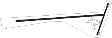
Airport details
| Country | Spain |
| State | Castile and León |
| Region | LE |
| Airspace | Madrid Ctr |
| Municipality | Garray |
| Elevation | 3400ft (1036m) |
| Timezone | GMT +1 |
| Coordinates | 41.81937, -2.47311 |
| Magnetic var | |
| Type | land |
| Available since | X-Plane v10.40 |
| ICAO code | LEGY |
| IATA code | n/a |
| FAA code | n/a |
Communication
Nearby Points of Interest:
Archivo Histórico Provincial de Soria
-Palace of los Ríos y Salcedo
-Biblioteca Pública del Estado en Soria
-Monte Valonsadero
-Hermitage of La Monjía
-Casa de la Media Naranja
-Church of San Millán, Oncala
-Castle of Peroniel
-iglesia de Nuestra Señora del Collado (Valtajeros)
-funerary stele of Antestius Sesenco
-Magaña Castle
-Castillo de San Pedro Manrique
-Iglesia de Nuestra Señora de la Asunción
-Iglesia de Nuestra Señora de la Blanca
-Palacio de los Altamira
-Hermitage of Saint Mammes, Montenegro de Cameros
-puente de Santo Domingo (Covaleda)
-Castle of Serón de Nágima
-Town hall in Ágreda
-Torre de la Muela, Ágreda
-Arab arch
-Peñalcázar
-Castillo de Ciria
-Church of Our Lady of Malanca

Nearby beacons
| code | identifier | dist | bearing | frequency |
|---|---|---|---|---|
| BAN | BARAHONA VOR/DME | 30.5 | 198° | 112.80 |
| EAG | LOGRONO NDB | 38.6 | 14° | 399 |
| LPA | LOGRONO VOR/DME | 39 | 13° | 115.45 |
| DGO | DOMINGO VOR/DME | 42.1 | 327° | 112.60 |
| TBR | BARDENAS REALES TACAN | 49.9 | 69° | 108.60 |
| VRA | VITORIA VOR/DME | 57.5 | 337° | 116.60 |
| VT | VITORIA NDB | 60.8 | 341° | 308 |
| PAP | PAMPLONA SOUTH VOR/DME | 63.4 | 43° | 113.55 |
| PPN | PAMPLONA VOR/DME | 64.7 | 40° | 112.30 |
| PAM | PAMPLONA NDB | 65.2 | 43° | 422 |
| RBO | ROBLEDILLO VOR/DME | 67.6 | 219° | 113.95 |
Disclaimer
The information on this website is not for real aviation. Use this data with the X-Plane flight simulator only! Data taken with kind consent from X-Plane 12 source code and data files. Content is subject to change without notice.