Marugan
Airport details
| Country | Spain |
| State | Castile and León |
| Region | LE |
| Airspace | Madrid Ctr |
| Municipality | Marugan |
| Elevation | 3080ft (939m) |
| Timezone | GMT +1 |
| Coordinates | 40.91056, -4.36972 |
| Magnetic var | |
| Type | land |
| Available since | X-Plane v10.40 |
| ICAO code | LEIR |
| IATA code | n/a |
| FAA code | n/a |
Communication
| Marugan EMERGENCY | 121.500 |
| Marugan TOWER | 123.500 |
Nearby Points of Interest:
Hermitage of San Miguel de Párraces
-Nuestra Señora de la Asunción Church (Paradinas, Spain)
-Church of Santo Tomás de Canterbury, Vegas de Matute
-Church of San Nicolás de Bari, Navas de San Antonio
-Church of San Juan Evangelista, La Losa
-Our Lady of Cubillo
-Palacio de Enrique IV, Segovia
-Seminario Conciliar de Segovia
-Biblioteca de la Academia de Artillería
-Aqueduct of Segovia
-Monastery of Santa Cruz la Real, Segovia
-Museo de Segovia
-Old Town of Segovia and its Aqueduct
-Cerro de la Virgen del Castillo
-Iglesia de San Bartolomé
-Conjunto Histórico de Arévalo
-Church of Santo Domingo, Santo Domingo de Pirón
-Peñalara Natural Park
-Church of Santo Domingo, Ávila
-Paraje Pintoresco del Pinar de Abantos y Zona de La Herrería
-El Campillo, El Escorial
-Royal Monastery of Santa Ana, Ávila
-Monastery of the Encarnación, Ávila
-Monastery of San Francisco, Ávila
-Church of San Vicente Mártir, Pelayos del Arroyo
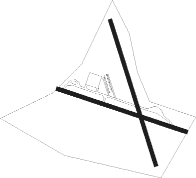
Runway info
Runway 12 / 30  | ||
| length | 587m (1926ft) | |
| bearing | 108° / 288° | |
| width | 18m (59ft) | |
| surface | asphalt | |
| displ threshold | 97m (318ft) / 82m (269ft) | |
| Runway 17 / 35 | ||
| length | 657m (2156ft) | |
| bearing | 163° / 343° | |
| width | 18m (59ft) | |
| surface | dirt | |
| blast zone | 31m (102ft) / 47m (154ft) | |
Nearby beacons
| code | identifier | dist | bearing | frequency |
|---|---|---|---|---|
| ECV | COLMENAR VIEJO NDB | 30.3 | 109° | 319 |
| CNR | COLMENAR VIEJO VOR/DME | 32.9 | 113° | 117.30 |
| NVS | NAVAS DEL REY VOR/DME | 33 | 167° | 114.95 |
| SIE | SOMOSIERRA VOR/DME | 37.5 | 73° | 115.40 |
| SSY | S.S.REYES VOR/DME | 42.2 | 115° | 117.85 |
| CVT | CUATRO VIENTOS NDB | 42.4 | 132° | 417 |
| BRA | BARAJAS VOR/DME | 45.5 | 119° | 116.45 |
| VGE | GETAFE (MADRID) VORTAC | 47.4 | 134° | 112.05 |
| VTZ | TORREJON (MADRID) VOR/DME | 48.5 | 116° | 115.10 |
| TJZ | TORREJON (MADRID) TACAN | 48.8 | 114° | 112.50 |
| GE | GETAFE (MADRID) NDB | 48.9 | 144° | 421 |
| NUB | VILLANUBLA (VALLADOLID) VOR/DME | 52.4 | 329° | 113.65 |
| TLD | TOLEDO VOR/DME | 56.5 | 178° | 113.20 |
Disclaimer
The information on this website is not for real aviation. Use this data with the X-Plane flight simulator only! Data taken with kind consent from X-Plane 12 source code and data files. Content is subject to change without notice.