León - Leon
Airport details
| Country | Spain |
| State | Castile and León |
| Region | LE |
| Airspace | Madrid Ctr |
| Municipality | Valverde de la Virgen |
| Elevation | 3003ft (915m) |
| Timezone | GMT +1 |
| Coordinates | 42.58829, -5.65231 |
| Magnetic var | |
| Type | land |
| Available since | X-Plane v10.40 |
| ICAO code | LELN |
| IATA code | LEN |
| FAA code | n/a |
Communication
| Leon Tower | 122.100 |
| Leon Approach | 122.100 |
Approach frequencies
| ILS-cat-I | RW23 | 109.5 | 18.00mi |
| 3.5° GS | RW23 | 109.5 | 18.00mi |
Nearby Points of Interest:
Chemical Plant Abelló, León
-Biblioteca Pública del Estado en León
-Teatro Trianón
-Castillo de León
-Archivo Histórico Provincial de León
-French Way
-Santa María de Carrizo
-Convento de San Agustín (Mansilla de las Mulas)
-Church of Asunción de Nuestra Señora, Grisuela del Páramo
-Church of Asunción de Nuestra Señora, Villacé
-Rollo de justicia de Villademor de la Vega
-Castle of Benal
-Bedunia
-Villapadierna Castle
-Ferrería de San Blas
-Monasterio de San Juan de Montealegre
-Monastery of Santa María de Nogales
-Monastery of Santa María de Trianos
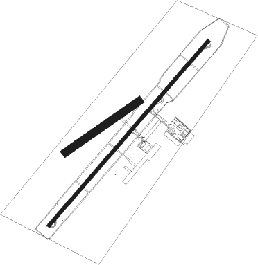
Runway info
Runway 05 / 23  | ||
| length | 2996m (9829ft) | |
| bearing | 54° / 234° | |
| width | 45m (148ft) | |
| surface | asphalt | |
| blast zone | 0m (0ft) / 58m (190ft) | |
| Runway 06 / 24 | ||
| length | 1098m (3602ft) | |
| bearing | 67° / 247° | |
| width | 100m (328ft) | |
| surface | dirt | |
Nearby beacons
| code | identifier | dist | bearing | frequency |
|---|---|---|---|---|
| EON | LEON VOR/DME | 0.4 | 48° | 112 |
| AV | ASTURIAS NDB | 58.3 | 344° | 387 |
| VES | ASTURIAS VOR/DME | 60.2 | 340° | 112.40 |
| AST | ASTURIAS NDB | 60.5 | 339° | 325 |
| NUB | VILLANUBLA (VALLADOLID) VOR/DME | 63.9 | 138° | 113.65 |
Departure and arrival routes
| Transition altitude | 6000ft |
| SID end points | distance | outbound heading | |
|---|---|---|---|
| RW05 | |||
| RATA2G | 72mi | 90° | |
| ZMR2G | 64mi | 179° | |
| ROVA1G | 13mi | 307° | |
| RW23 | |||
| RATA1H | 72mi | 90° | |
| ZMR1H | 64mi | 179° | |
| ROVA1H | 13mi | 307° | |
| STAR starting points | distance | inbound heading | |
|---|---|---|---|
| RW05 | |||
| ROVA1E | 12.8 | 127° | |
| RATA4E | 71.7 | 270° | |
| ZMR2E | 63.5 | 359° | |
| RW23 | |||
| ROVA1F | 12.8 | 127° | |
| RATA3F | 71.7 | 270° | |
| ZMR1F | 63.5 | 359° | |
Holding patterns
| STAR name | hold at | type | turn | heading* | altitude | leg | speed limit |
|---|---|---|---|---|---|---|---|
| RATA3F | JOCOL | VHF | left | 92 (272)° | > 7000ft | 1.0min timed | ICAO rules |
| RATA4E | EON | NDB | left | 55 (235)° | > 13000ft | 1.0min timed | ICAO rules |
| RATA4E | JOCOL | VHF | left | 92 (272)° | > 7000ft | 1.0min timed | ICAO rules |
| ROVA1E | EON | NDB | left | 55 (235)° | > 13000ft | 1.0min timed | ICAO rules |
| ROVA1F | EON | NDB | left | 55 (235)° | > 13000ft | 1.0min timed | ICAO rules |
| ROVA1F | JOCOL | VHF | left | 92 (272)° | > 7000ft | 1.0min timed | ICAO rules |
| ZMR1F | EON | NDB | left | 55 (235)° | > 13000ft | 1.0min timed | ICAO rules |
| ZMR1F | JOCOL | VHF | left | 92 (272)° | > 7000ft | 1.0min timed | ICAO rules |
| ZMR2E | EON | NDB | left | 55 (235)° | > 13000ft | 1.0min timed | ICAO rules |
| *) magnetic outbound (inbound) holding course | |||||||
Disclaimer
The information on this website is not for real aviation. Use this data with the X-Plane flight simulator only! Data taken with kind consent from X-Plane 12 source code and data files. Content is subject to change without notice.