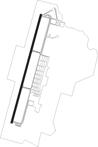
Morón - Moron Air Base
Airport details
| Country | Spain |
| State | Andalusia |
| Region | LE |
| Airspace | Madrid Ctr |
| Municipality | Arahal |
| Elevation | 285ft (87m) |
| Timezone | GMT +1 |
| Coordinates | 37.17018, -5.61061 |
| Magnetic var | |
| Type | land |
| Available since | X-Plane v10.32 |
| ICAO code | LEMO |
| IATA code | OZP |
| FAA code | n/a |
Communication
| Moron Air Base Tower | 122.100 |
| Moron Air Base SEVILLA Approach | 128.500 |
| Moron Air Base SEVILLA Approach | 120.000 |
| Moron Air Base SEVILLA Approach | 120.800 |
Approach frequencies
| ILS-cat-I | RW20 | 109.7 | 18.00mi |
| 3° GS | RW20 | 109.7 | 18.00mi |
Nearby Points of Interest:
Tower of Lopera
-archaeological site of Carmona
-Alcázar del rey Don Pedro
-Divino Salvador Church, Carmona
-Carissa Aurelia
-Antigua Universidad Laboral
-Casa Luca de Tena
-Casa Duclós
-Pabellón de Cuba para la Exposición Iberoamericana de 1929
-Lugar del Fusilamiento de Blas Infante
-Pabellón de México para la Exposición Iberoamericana de 1929
-Pabellón de Colombia para la Exposición Iberoamericana de 1929
-Pabellón Domecq en la Exposición Iberoamericana de 1929
-Real Fábrica de Artillería of Seville
-Viviendas y Estación de Autobuses del Prado de San Sebastián
-Pabellón de Portugal en la Exposición Iberoamericana de 1929
-Seville Public Library
-Convento del Corpus Christi
-Ermita de la Vera Cruz
-iglesia de Santa María de la Estrella
-Palacio de Mañara
-Palacio de San Telmo
-Yacimiento arqueológico del Cortijo de Miraflores y Huerta de la Albarrana
-La Carbonería
-Hospital de los Venerables
Runway info
| Runway 02 / 20 | ||
| length | 3603m (11821ft) | |
| bearing | 24° / 204° | |
| width | 61m (200ft) | |
| surface | asphalt | |
| blast zone | 255m (837ft) / 255m (837ft) | |
Nearby beacons
| code | identifier | dist | bearing | frequency |
|---|---|---|---|---|
| MRN | MORON (SEVILLE) VOR/DME | 0.4 | 301° | 115.50 |
| SVL | SEVILLE VOR/DME | 17 | 330° | 113.70 |
| SPP | SEVILLE NDB | 17.3 | 323° | 420 |
| EEC | EL COPERO (SEVILLA) NDB | 20.5 | 290° | 327 |
| JER | JEREZ NDB | 28 | 230° | 433 |
| JRZ | JEREZ VOR/DME | 29.1 | 230° | 113 |
| MAR | MARTIN VOR/DME | 32.8 | 100° | 112.60 |
| AOG | ROTA TACAN | 47.3 | 235° | 108.60 |
| CDB | CORDOBA VOR/DME | 54.5 | 48° | 112.40 |
| VJF | VEJER DE LA FRONTERA VOR/DME | 58.5 | 201° | 117.80 |
Departure and arrival routes
| Transition altitude | 6000ft |
| SID end points | distance | outbound heading | |
|---|---|---|---|
| RW02 | |||
| MD125I | 110mi | 9° | |
| MD98I | 128mi | 64° | |
| MD169I | 73mi | 136° | |
| MGOLFO | 48mi | 256° | |
| MD123I | 49mi | 291° | |
| MR86I | 50mi | 314° | |
| RW20 | |||
| MD125I | 110mi | 9° | |
| HIJ2X, HIJ2W | 84mi | 21° | |
| ALCO2W | 66mi | 58° | |
| MD98I | 128mi | 64° | |
| MGA2W | 63mi | 106° | |
| MD169I | 73mi | 136° | |
| VJF2W | 59mi | 201° | |
| CLAN2W | 67mi | 239° | |
| MGOLFO | 48mi | 256° | |
| ANDE1W | 49mi | 283° | |
| MD123I | 49mi | 291° | |
| SANT1W | 44mi | 306° | |
| MR86I | 50mi | 314° | |
| STAR starting points | distance | inbound heading | |
|---|---|---|---|
| ALL | |||
| MGOLFV | 48.1 | 76° | |
| MD123V | 48.5 | 111° | |
| MR86V | 49.6 | 134° | |
| MD125V | 109.5 | 189° | |
| HIJ1Y | 83.9 | 201° | |
| BLN1Y | 111.3 | 244° | |
| MD98V | 127.7 | 244° | |
| MD169V | 73.4 | 316° | |
Disclaimer
The information on this website is not for real aviation. Use this data with the X-Plane flight simulator only! Data taken with kind consent from X-Plane 12 source code and data files. Content is subject to change without notice.
