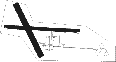
Toledo - Ocana
Airport details
| Country | Spain |
| State | Castile-La Mancha |
| Region | LE |
| Airspace | Madrid Ctr |
| Municipality | Ocaña |
| Elevation | 2401ft (732m) |
| Timezone | GMT +1 |
| Coordinates | 39.93750, -3.50333 |
| Magnetic var | |
| Type | land |
| Available since | X-Plane v10.40 |
| ICAO code | LEOC |
| IATA code | n/a |
| FAA code | n/a |
Communication
| OCANA ATC Torre | 122.600 |
Nearby beacons
| code | identifier | dist | bearing | frequency |
|---|---|---|---|---|
| VTB | VILLATOBAS VOR/DME | 9.5 | 166° | 112.70 |
| PDT | PERALES VOR/DME | 20.2 | 26° | 116.95 |
| GE | GETAFE (MADRID) NDB | 22.2 | 308° | 421 |
| VGE | GETAFE (MADRID) VORTAC | 23.5 | 328° | 112.05 |
| CVT | CUATRO VIENTOS NDB | 28.6 | 328° | 417 |
| BRA | BARAJAS VOR/DME | 32 | 354° | 116.45 |
| VTZ | TORREJON (MADRID) VOR/DME | 32.3 | 3° | 115.10 |
| TJZ | TORREJON (MADRID) TACAN | 33.8 | 6° | 112.50 |
| SSY | S.S.REYES VOR/DME | 36.7 | 353° | 117.85 |
| TLD | TOLEDO VOR/DME | 38.4 | 272° | 113.20 |
| NVS | NAVAS DEL REY VOR/DME | 42.9 | 300° | 114.95 |
| CNR | COLMENAR VIEJO VOR/DME | 43.8 | 342° | 117.30 |
| ECV | COLMENAR VIEJO NDB | 47.2 | 341° | 319 |
| CJN | CASTEJON VOR/DME | 51.1 | 66° | 115.60 |
| RBO | ROBLEDILLO VOR/DME | 56.2 | 16° | 113.95 |
| EAL | ALMAGRO (CIUDAD REAL) NDB | 60.2 | 194° | 332 |
Disclaimer
The information on this website is not for real aviation. Use this data with the X-Plane flight simulator only! Data taken with kind consent from X-Plane 12 source code and data files. Content is subject to change without notice.

