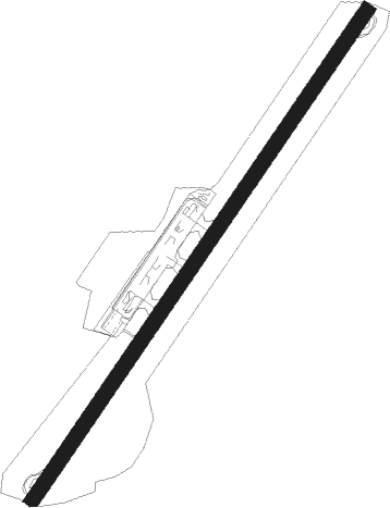
Hondarribia - San Sebastian
Airport details
| Country | Spain |
| State | Autonomous Community of the Basque Count |
| Region | LE |
| Airspace | Madrid Ctr |
| Municipality | Hondarribia/Fontarrabie |
| Elevation | 16ft (5m) |
| Timezone | GMT +1 |
| Coordinates | 43.35639, -1.79056 |
| Magnetic var | |
| Type | land |
| Available since | X-Plane v10.40 |
| ICAO code | LESO |
| IATA code | EAS |
| FAA code | n/a |
Communication
| San Sebastian Ground Control | 121.700 |
| San Sebastian Tower | 119.850 |
| San Sebastian Approach | 119.850 |
| San Sebastian Departure | 121.700 |
Nearby beacons
| code | identifier | dist | bearing | frequency |
|---|---|---|---|---|
| HIG | SAN SEBASTIAN NDB | 1.8 | 350° | 328 |
| SSN | SAN SEBASTIAN VOR/DME | 3.2 | 221° | 117.90 |
| BTZ | BIARRITZ PAYS BASQUE VOR/DME | 13.9 | 69° | 114.15 |
| BZ | BIARRITZ PAYS BASQUE NDB | 18.2 | 74° | 341 |
| PP | PAMPLONA NDB | 29.5 | 171° | 354 |
| PPN | PAMPLONA VOR/DME | 37.5 | 172° | 112.30 |
| DX | DAX SEYRESSE NDB | 39 | 66° | 334 |
| PAM | PAMPLONA NDB | 39.1 | 167° | 422 |
| PAP | PAMPLONA SOUTH VOR/DME | 40.5 | 169° | 113.55 |
| VTA | VITORIA NDB | 46.6 | 244° | 345 |
| VFD | VITORIA-FORONDA VOR/DME | 49.9 | 243° | 112.90 |
| LPA | LOGRONO VOR/DME | 58.7 | 211° | 115.45 |
| EAG | LOGRONO NDB | 59 | 210° | 399 |
Departure and arrival routes
| Transition altitude | 6000ft |
| SID end points | distance | outbound heading | |
|---|---|---|---|
| RW04 | |||
| BTZ1B, BTZ1Z | 14mi | 69° | |
| PPN1W, PPN1B | 38mi | 172° | |
| CEGA3D | 30mi | 230° | |
| BLV1Z, BLV3B | 50mi | 267° | |
| RW22 | |||
| BTZ2A | 14mi | 69° | |
| PPN1C, PPN1U | 38mi | 172° | |
| CEGA2E, CEGA2Y | 30mi | 230° | |
| BLV1A | 50mi | 267° | |
Instrument approach procedures
| runway | airway (heading) | route (dist, bearing) |
|---|---|---|
| RW22-Y | BTZ (249°) | BTZ 3000ft SO10E (6mi, 281°) 2500ft |
| RW22-Y | OSGOT (218°) | OSGOT 3000ft SO10E (8mi, 204°) 2500ft |
| RW22-Y | YESYO (115°) | YESYO 4100ft SO500 (12mi, 68°) 2500ft SO10E (6mi, 120°) 2500ft |
| RNAV | SO10E 2500ft SO06E (4mi, 228°) 2100ft LESO (6mi, 228°) 62ft SO521 (4mi, 228°) SO522 (6mi, 241°) YESYO (12mi, 349°) 4100ft YESYO (turn) 4100ft | |
| RW22-Z | BTZ (249°) | BTZ 3000ft SO10E (6mi, 281°) 2500ft |
| RW22-Z | OSGOT (218°) | OSGOT 3000ft SO10E (8mi, 204°) 2500ft |
| RW22-Z | YESYO (115°) | YESYO 4100ft SO500 (12mi, 68°) 2500ft SO10E (6mi, 120°) 2500ft |
| RNAV | SO10E 2500ft SO06E (4mi, 228°) 2100ft SO02E (4mi, 228°) 755ft SO510 (12mi, 274°) 2900ft YESYO (3mi, 41°) 4100ft YESYO (turn) 4100ft | |
| RWNVA | YESYO (115°) | YESYO 4100ft SO400 (6mi, 239°) 3500ft SO401 (8mi, 167°) 3500ft SO402 (5mi, 91°) 2900ft |
| RNAV | SO402 2900ft SO06W (3mi, 74°) 2400ft LESO (7mi, 48°) 59ft SO412 (4mi, 38°) YESYO (11mi, 279°) 4100ft YESYO (turn) 4100ft |
Holding patterns
| STAR name | hold at | type | turn | heading* | altitude | leg | speed limit |
|---|---|---|---|---|---|---|---|
| SSN1J | HIG | FIX | left | 199 (19)° | > 5000ft | 1.0min timed | ICAO rules |
| SSN1J | SSN | NDB | right | 214 (34)° | > 5200ft | DME 6.0mi | 220 |
| SSN1L | SSN | NDB | right | 214 (34)° | > 5200ft | DME 6.0mi | 220 |
| SSN1L | YESYO | VHF | left | 140 (320)° | > 4100ft | 1.0min timed | 230 |
| SSN1T | YESYO | VHF | left | 140 (320)° | > 4100ft | 1.0min timed | 230 |
| *) magnetic outbound (inbound) holding course | |||||||
Disclaimer
The information on this website is not for real aviation. Use this data with the X-Plane flight simulator only! Data taken with kind consent from X-Plane 12 source code and data files. Content is subject to change without notice.
