Zaragoza
Airport details
| Country | Spain |
| State | Aragon |
| Region | LE |
| Airspace | Madrid Ctr |
| Municipality | Zaragoza |
| Elevation | 859ft (262m) |
| Timezone | GMT +1 |
| Coordinates | 41.66458, -1.06165 |
| Magnetic var | |
| Type | land |
| Available since | X-Plane v10.40 |
| ICAO code | LEZG |
| IATA code | ZAZ |
| FAA code | n/a |
Communication
| Zaragoza Ground Control | 118.100 |
| Zaragoza Tower | 122.100 |
| Zaragoza Approach | 119.300 |
| Zaragoza Approach | 127.050 |
Approach frequencies
| ILS-cat-III | RW30R | 109.5 | 18.00mi |
| 3° GS | RW30R | 109.5 | 18.00mi |
Nearby Points of Interest:
Church of Nuestra Señora de la Asunción, Utebo
-The church of San Andrés (Torres de Berrellén)
-Estación de servicio Los Enlaces
-Castle of Turbena
-Azucarera de Nuestra Señora de las Mercedes
-Building in Jota Aragonesa St. 3 y 5, Alagón
-Torre de los Condes de Bureta
-Patio de Santa Isabel
-Castillo de Juslibol
-Grupo Escolar Joaquín Costa
-Edificio Pignatelli
-Quiosco de la Música, Zaragoza
-Dominican Convent, Zaragoza
-Castle of Urrea de Jalon
-Almagro 5, Zaragoza
-Hospital Provincial de Nuestra Señora de Gracia
-Paraninfo de la Universidad de Zaragoza
-Palacio de los Duques de Villahermosa
-Antigua Clínica del Doctor Lozano
-Armas 32, Zaragoza
-Paseo de Sagasta 40, Zaragoza
-Paseo de Sagasta
-palacio de los Luna
-Mercado de Lanuza
-La Adriática building
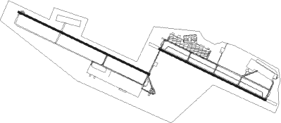
Runway info
Runway 12L / 30R  | ||
| length | 3028m (9934ft) | |
| bearing | 113° / 293° | |
| width | 45m (148ft) | |
| surface | asphalt | |
| blast zone | 255m (837ft) / 255m (837ft) | |
| Runway 12R / 30L | ||
| length | 3713m (12182ft) | |
| bearing | 113° / 293° | |
| width | 45m (148ft) | |
| surface | asphalt | |
| blast zone | 255m (837ft) / 255m (837ft) | |
Nearby beacons
| code | identifier | dist | bearing | frequency |
|---|---|---|---|---|
| ZZA | ZARAGOZA TACAN | 0.7 | 14° | 133.70 |
| ZAR | ZARAGOZA VOR/DME | 1.4 | 102° | 113 |
| ZRZ | ZARAGOZA NDB | 7.1 | 297° | 389 |
| TON | TORRALBA DE ARAGON NDB | 29.1 | 64° | 335 |
| TBR | BARDENAS REALES TACAN | 36.9 | 322° | 108.60 |
| HUE | HUESCA VOR/DME | 41.3 | 61° | 114.55 |
| CMA | CALAMOCHA VOR/DME | 49 | 197° | 116 |
| MLA | MAELLA VOR/DME | 63.9 | 114° | 112.10 |
| LLE | ILERDA VOR/DME | 71.3 | 88° | 113.60 |
Departure and arrival routes
| Transition altitude | 6000ft |
| SID end points | distance | outbound heading | |
|---|---|---|---|
| RW12 (ALL) | |||
| SURC2C | 46mi | 37° | |
| MARI2C | 49mi | 56° | |
| GRAU2H | 67mi | 78° | |
| PONE2A | 30mi | 121° | |
| CMA3D | 49mi | 197° | |
| RW30 (ALL) | |||
| SURC1D, SURC1E | 46mi | 37° | |
| MARI1D | 49mi | 56° | |
| GRAU1M | 67mi | 78° | |
| PONE1B | 30mi | 121° | |
| CMA2E | 49mi | 197° | |
| ALEP2B | 57mi | 307° | |
| STAR starting points | distance | inbound heading | |
|---|---|---|---|
| ALL | |||
| CMA2B | 49.0 | 17° | |
| BRIT1A | 57.7 | 60° | |
| MLA1L | 63.9 | 294° | |
| RW12 (ALL) | |||
| CMA2A | 49.0 | 17° | |
| ALEP2A | 57.2 | 127° | |
| SURC1A | 45.5 | 217° | |
| MARI1A | 49.0 | 236° | |
| GRAU1U | 67.0 | 258° | |
| LOBA1U | 62.0 | 267° | |
| MLA1K | 63.9 | 294° | |
| RW12R | |||
| CM2DCA | 49.0 | 17° | |
| XE1DCA | 60.5 | 59° | |
| AL2DCA | 57.2 | 127° | |
| RO1DCA | 49.9 | 182° | |
| SU1DCA | 45.5 | 217° | |
| GR1DCA | 67.0 | 258° | |
| LO1DCA | 62.0 | 267° | |
| ML1DCA | 63.9 | 294° | |
| RW30 (ALL) | |||
| CMA3C | 49.0 | 17° | |
| SURC2B | 45.5 | 217° | |
| MARI2B | 49.0 | 236° | |
| GRAU2V | 67.0 | 258° | |
| LOBA2V | 62.0 | 267° | |
| MLA2Q, MLA2M | 63.9 | 294° | |
| RW30R | |||
| CM2DCB | 49.0 | 17° | |
| XE1DCB | 60.5 | 59° | |
| AL2DCB | 57.2 | 127° | |
| RO1DCB | 49.9 | 182° | |
| SU1DCB | 45.5 | 217° | |
| GR1DCB | 67.0 | 258° | |
| LO1DCB | 62.0 | 267° | |
| ML2DCB | 63.9 | 294° | |
Holding patterns
| STAR name | hold at | type | turn | heading* | altitude | leg | speed limit |
|---|---|---|---|---|---|---|---|
| ALEP2A | ZRZ | FIX | left | 137 (317)° | > 5000ft | 1.0min timed | ICAO rules |
| CMA2A | ZRZ | FIX | left | 137 (317)° | > 5000ft | 1.0min timed | ICAO rules |
| CMA3C | BUROV | VHF | left | 118 (298)° | > 5000ft | 1.0min timed | ICAO rules |
| GRAU1U | TON | FIX | right | 88 (268)° | > 5000ft | 1.0min timed | ICAO rules |
| GRAU1U | ZRZ | FIX | left | 137 (317)° | > 5000ft | 1.0min timed | ICAO rules |
| GRAU2V | BUROV | VHF | left | 118 (298)° | > 5000ft | 1.0min timed | ICAO rules |
| GRAU2V | TON | FIX | right | 88 (268)° | > 5000ft | 1.0min timed | ICAO rules |
| LOBA1U | TON | FIX | right | 88 (268)° | > 5000ft | 1.0min timed | ICAO rules |
| LOBA1U | ZRZ | FIX | left | 137 (317)° | > 5000ft | 1.0min timed | ICAO rules |
| LOBA2V | BUROV | VHF | left | 118 (298)° | > 5000ft | 1.0min timed | ICAO rules |
| LOBA2V | TON | FIX | right | 88 (268)° | > 5000ft | 1.0min timed | ICAO rules |
| MARI1A | TON | FIX | right | 88 (268)° | > 5000ft | 1.0min timed | ICAO rules |
| MARI1A | ZRZ | FIX | left | 137 (317)° | > 5000ft | 1.0min timed | ICAO rules |
| MARI2B | BUROV | VHF | left | 118 (298)° | > 5000ft | 1.0min timed | ICAO rules |
| MARI2B | TON | FIX | right | 88 (268)° | > 5000ft | 1.0min timed | ICAO rules |
| MLA1K | ZRZ | FIX | left | 137 (317)° | > 5000ft | 1.0min timed | ICAO rules |
| MLA2M | BUROV | VHF | left | 118 (298)° | > 5000ft | 1.0min timed | ICAO rules |
| MLA2Q | BUROV | VHF | left | 118 (298)° | > 5000ft | 1.0min timed | ICAO rules |
| SURC1A | TON | FIX | right | 88 (268)° | > 5000ft | 1.0min timed | ICAO rules |
| SURC1A | ZRZ | FIX | left | 137 (317)° | > 5000ft | 1.0min timed | ICAO rules |
| SURC2B | BUROV | VHF | left | 118 (298)° | > 5000ft | 1.0min timed | ICAO rules |
| SURC2B | TON | FIX | right | 88 (268)° | > 5000ft | 1.0min timed | ICAO rules |
| *) magnetic outbound (inbound) holding course | |||||||
Disclaimer
The information on this website is not for real aviation. Use this data with the X-Plane flight simulator only! Data taken with kind consent from X-Plane 12 source code and data files. Content is subject to change without notice.