Mont Sur Meurthe
Airport details
| Country | France |
| State | Grand Est |
| Region | LF |
| Airspace | Reims Ctr |
| Municipality | Mont-sur-Meurthe |
| Elevation | 812ft (247m) |
| Timezone | GMT +1 |
| Coordinates | 48.53986, 6.43998 |
| Magnetic var | |
| Type | land |
| Available since | X-Plane v10.40 |
| ICAO code | LF5421 |
| IATA code | n/a |
| FAA code | n/a |
Communication
| Mont sur Meurthe ATC Freq | 123.500 |
| Mont sur Meurthe Dep | 123.500 |
Nearby Points of Interest:
Abbaye Saint-Rémy de Lunéville
-Château de Gerbéviller
-Maison du Marchand
-Immeuble, 61 rue de Lorraine
-Manège des Gendarmes rouges
-Château de la Favorite
-Pont sur le Sânon
-château de Lenoncourt
-Poste de secours de Domjevin
-château de l'abbé de Bouzey
-papeterie de la Rochette
-Maison des Loups
-villa Fournier-Defaut
-Maison Fruhinsholzs
-immeuble, 10 rue des Sœurs-Macarons
-Daum
-site archéologique d'Essey-Nancy
-Tour Joffre Saint-Thiébaut
-maison Lecreulx
-L'Excelsior
-Immeuble, 38 place de la Carrière
-Hôtel de ville de Rambervillers
-Cure d'air Trianon
-Manufacture vosgienne de grandes orgues
-funiculaire de la Cure d'Air
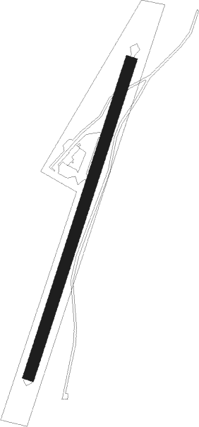
Runway info
| Runway 02 / 20 | ||
| length | 704m (2310ft) | |
| bearing | 32° / 212° | |
| width | 25m (82ft) | |
| surface | grass | |
| blast zone | 30m (98ft) / 45m (148ft) | |
Nearby beacons
| code | identifier | dist | bearing | frequency |
|---|---|---|---|---|
| EMT | EPINAL NDB | 15.8 | 230° | 419 |
| NAY | NANCY OCHEY TACAN | 19.5 | 275° | 116.80 |
| EPL | EPINAL MIRECOURT VOR | 20.1 | 240° | 113 |
| LOU | LORRAINE NDB | 28.3 | 340° | 388 |
| GTQ | GROSTENQUIN VOR/DME | 28.9 | 32° | 111.25 |
| PHG | PHALSBOURG NDB | 33 | 73° | 424 |
| HO | COLMAR-HOUSSEN NDB | 44.2 | 114° | 380 |
| MTZ | METZ NDB | 45.1 | 343° | 354 |
| LXI | LUXEUIL SAINT SAUVEUR TACAN | 45.5 | 186° | 108.20 |
| SAD | DME | 48.4 | 45° | 116.75 |
| SR | ENSHEIM (SAARBRUECKEN) NDB | 51 | 49° | 360 |
| ETN | ETAIN NDB | 51.2 | 312° | 410 |
| LUL | LUXEUIL VOR | 51.4 | 190° | 117.10 |
| ZWN | ZWEIBRUECKEN VOR/DME | 56.6 | 55° | 114.80 |
| HR | HERICOURT NDB | 59.9 | 163° | 289 |
Disclaimer
The information on this website is not for real aviation. Use this data with the X-Plane flight simulator only! Data taken with kind consent from X-Plane 12 source code and data files. Content is subject to change without notice.