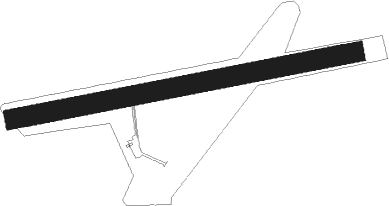
La Flèche - La Fleche Thoree Les Pins
Airport details
| Country | France |
| State | Pays de la Loire |
| Region | LF |
| Airspace | Paris Ctr |
| Municipality | La Flèche |
| Elevation | 121ft (37m) |
| Timezone | GMT +1 |
| Coordinates | 47.69278, -0.00194 |
| Magnetic var | |
| Type | land |
| Available since | X-Plane v10.40 |
| ICAO code | LFAL |
| IATA code | n/a |
| FAA code | n/a |
Communication
| La Fleche Thoree les pins ATC Freq | 123.500 |
| La Fleche Thoree les pins CTAF Dep | 123.500 |
Nearby Points of Interest:
Château de Créans
-Monastery of the Visitation
-Hôtel Huger de Vernelles
-Halle de la Flèche
-Château des Carmes
-Prieuré de Luché
-Manoir de Venevelles
-Château de Clefs
-Château du Maurier
-Maison des Architectes
-Pavillon de Malidor
-Prieuré Sainte-Marie-Madeleine d'Oizé
-Briqueterie Le Croc
-Château des Gringuenières
-Manoir de Sarceau
-Couvent des Bénédictines de Baugé
-Prieuré de Château-l'Hermitage
-Château-Bosset
-Logis de Lizardière
-Château des Perrays (Parigné-le-Pôlin)
-Ferme de la Petite-Voisine
-Manoir de Clairefontaine (Le Vieil-Baugé)
-Calvaire de Parcé-sur-Sarthe
-Château de Vaulogé
-Presbytère de Chartrené
Nearby beacons
| code | identifier | dist | bearing | frequency |
|---|---|---|---|---|
| AS | ANGERS NDB | 9.2 | 232° | 392 |
| LM | LE MANS NDB | 13.9 | 41° | 326 |
| LA | LAVAL NDB | 32.1 | 293° | 401 |
| TUR | TOURS VAL DE LOIRE NDB | 32.6 | 99° | 331 |
| TUR | TOURS VAL DE LOIRE TACAN | 33.8 | 110° | 113.80 |
| ANG | ANGERS VOR | 35.6 | 260° | 113 |
| LP | CHOLET NDB | 47.7 | 236° | 357 |
| PI | POITIERS NDB | 61.6 | 158° | 363 |
| CHW | CHARTRES VOR/DME | 61.7 | 51° | 115.20 |
Disclaimer
The information on this website is not for real aviation. Use this data with the X-Plane flight simulator only! Data taken with kind consent from X-Plane 12 source code and data files. Content is subject to change without notice.