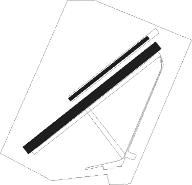
Berck Sur Mer
Airport details
| Country | France |
| State | Hauts-de-France |
| Region | LF |
| Airspace | Paris Ctr |
| Municipality | Berck |
| Elevation | 29ft (9m) |
| Timezone | GMT +1 |
| Coordinates | 50.42305, 1.59194 |
| Magnetic var | |
| Type | land |
| Available since | X-Plane v10.40 |
| ICAO code | LFAM |
| IATA code | n/a |
| FAA code | n/a |
Communication
| Berck Sur Mer BERCK Tower | 123.500 |
Nearby Points of Interest:
Église Saint-Nicolas de Merlimont
-Église Notre-Dame-de-Réconfort de Cucq
-Église de Fort-Mahon-Plage
-Villa Nirvana
-Casino de la forêt
-Villa Karidja
-Villa Glenwood
-Villa La Closerie
-Villa Le Castel
-Marché couvert du Touquet-Paris-Plage
-Villa Tata Ice
-Villa Saint-Augustin, Thalassa, Phébus et Borée
-Villa Les Mutins
-Hôtel des Postes du Touquet-Paris-Plage
-Villa Le Quart-d'Heure
-Villa Pomme d'Api
-Villa Wallonne
-Phare du Touquet
-Hippodrome du Touquet
-Villa Bic en coin
-Villa Alexandre
-Villa La Rafale
-maison à pans de bois de Montreuil
-monument aux morts de 1914-1918 de Montreuil
-hôtel de Longvilliers
Nearby beacons
| code | identifier | dist | bearing | frequency |
|---|---|---|---|---|
| BNE | BOULOGNE SUR MER VOR | 17 | 57° | 113.80 |
| ABB | ABBEVILLE VOR/DME | 20 | 138° | 108.45 |
| ING | SAINT INGLEVERT NDB | 28.2 | 18° | 387 |
| DPE | DIEPPE VOR | 33.9 | 220° | 115.80 |
| DSA | DIEPPE NDB | 37.9 | 223° | 351 |
| MK | CALAIS-DUNKERQUE NDB | 38.6 | 39° | 418 |
| MVC | MERVILLE NDB | 39 | 82° | 327 |
| LZD | LYDD NDB | 40.6 | 309° | 397 |
| LYD | LYDD VOR/DME | 43.9 | 309° | 114.05 |
| DVR | DOVER VOR/DME | 45.2 | 343° | 114.95 |
| GI | AMIENS NDB | 48.9 | 123° | 339 |
| HLS | DME | 56.6 | 308° | 115.95 |
| LSH | HEADCORN (LASHENDEN) NDB | 56.6 | 308° | 340 |
| BV | BEAUVAIS NDB | 58.4 | 155° | 391 |
| ROU | ROUEN VALLEE DE SEINE VOR | 58.7 | 198° | 116.80 |
| MTD | MONTDIDIER VOR | 62.7 | 134° | 113.65 |
| BOV | BEAUVAIS TILLE VOR/DME | 63.1 | 150° | 109.65 |
| DET | DETLING VOR/DME | 64.9 | 312° | 117.30 |
Disclaimer
The information on this website is not for real aviation. Use this data with the X-Plane flight simulator only! Data taken with kind consent from X-Plane 12 source code and data files. Content is subject to change without notice.

