Prouvy - Valenciennes Denain
Airport details
| Country | France |
| State | Hauts-de-France |
| Region | LF |
| Airspace | Paris Ctr |
| Municipality | Prouvy |
| Elevation | 165ft (50m) |
| Timezone | GMT +1 |
| Coordinates | 50.32479, 3.46544 |
| Magnetic var | |
| Type | land |
| Available since | X-Plane v10.40 |
| ICAO code | LFAV |
| IATA code | XVS |
| FAA code | n/a |
Communication
| Valenciennes Denain CTAF | 122.600 |
| Valenciennes Denain Twr | 122.600 |
| Valenciennes Denain LILLE Approach | 126.475 |
| Valenciennes Denain Dep | 122.600 |
Nearby Points of Interest:
Théâtre Municipal de Denain
-Collège des Jésuites de Valenciennes
-Hôtel de ville de Valenciennes
-Fosse Mathilde
-Le Gros Caillou
-Brasserie Laden Wallez
-Ferme d'Azincourt
-Château de Villers-Campeau
-city walls of Le Quesnoy
-Taufbecken Solesmes
-Chaire de l'église Saint-Martin de Solesmes
-northern French coal mining region
-Chapelle Notre-Dame-de-Bonsecours d'Écaillon
-Crespin Abbey
-tour sarrazine
-Basilica of Our Lady of Bon-Secours
-Chapelle Bricout d'Estourmel
-Fontaine des Brigittins
-pierres jumelles de Cambrai
-Bagacum
-Béguinage Saint-Vaast et Saint-Nicolas
-Béguinage Notre-Dame
-Citadelle de Cambrai
-Chaire de l'Église Saint-Géry
-Pierre qui Pousse
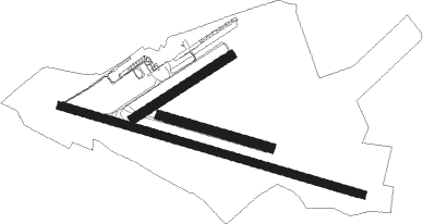
Runway info
Runway 11 / 29  | ||
| length | 1702m (5584ft) | |
| bearing | 104° / 284° | |
| width | 45m (148ft) | |
| surface | asphalt | |
| displ threshold | 172m (564ft) / 116m (381ft) | |
| Runway 06 / 24 | ||
| length | 626m (2054ft) | |
| bearing | 71° / 251° | |
| width | 50m (164ft) | |
| surface | grass | |
| Runway 11L / 29R | ||
| length | 621m (2037ft) | |
| bearing | 104° / 284° | |
| width | 50m (164ft) | |
| surface | grass | |
Nearby beacons
| code | identifier | dist | bearing | frequency |
|---|---|---|---|---|
| VS | VALENCIENNES NDB | 4.5 | 284° | 317 |
| CMB | CAMBRAI EPINOY VOR/DME | 13.3 | 253° | 112.60 |
| LL | LILLE NDB | 18.1 | 316° | 332 |
| LEQ | LILLE LESQUIN VOR/DME | 20.2 | 302° | 109 |
| CIV | CHIEVRES VORTAC | 20.5 | 56° | 113.20 |
| ABY | ALBERT BRAY NDB | 32.7 | 242° | 321 |
| MRV | MERVILLE NDB | 35.7 | 295° | 404 |
| MVC | MERVILLE NDB | 36.7 | 286° | 327 |
| GSY | GOSLY (CHARLEROI) VOR/DME | 38.1 | 82° | 115.70 |
| MAK | MACKEL NDB | 38.4 | 3° | 360 |
| AFI | AFFLIGEM VOR/DME | 43.4 | 49° | 114.90 |
| GI | AMIENS NDB | 47.6 | 244° | 339 |
| KOK | KOKSY VORTAC | 55.6 | 313° | 114.50 |
| ONO | OOSTENDE NDB | 56.4 | 333° | 399 |
| OO | OOSTENDE (OOSTENDE-BRUGGE) NDB | 56.9 | 328° | 375 |
| NIK | NICKY VOR/DME | 57.3 | 41° | 117.40 |
| DD | OOSTENDE (OOSTENDE-BRUGGE) NDB | 57.4 | 324° | 352 |
| MTD | MONTDIDIER VOR | 59.7 | 232° | 113.65 |
Instrument approach procedures
| runway | airway (heading) | route (dist, bearing) |
|---|---|---|
| RW11 | BOBMA (88°) | BOBMA 2000ft VAMOP (5mi, 30°) 2000ft |
| RW11 | NAVAN (122°) | NAVAN 2000ft VAMOP (5mi, 210°) 2000ft |
| RNAV | VAMOP 2000ft FAV11 (5mi, 104°) 2000ft LFAV (6mi, 104°) 211ft AV510 (2mi, 104°) BOBMA (14mi, 270°) 2000ft BOBMA (turn) | |
| RW29 | ERLED (274°) | ERLED 3000ft VADEP (4mi, 234°) 3000ft |
| RW29 | EXEKO (296°) | EXEKO 3000ft VADEP (5mi, 2°) 3000ft |
| RNAV | VADEP 3000ft FAV29 (5mi, 284°) 3000ft LFAV (9mi, 284°) 209ft AV410 (3mi, 284°) AV412 (4mi, 31°) AV414 (5mi, 78°) AV416 (3mi, 135°) 2000ft EXEKO (16mi, 136°) 3000ft EXEKO (turn) |
Disclaimer
The information on this website is not for real aviation. Use this data with the X-Plane flight simulator only! Data taken with kind consent from X-Plane 12 source code and data files. Content is subject to change without notice.