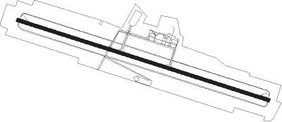
Agen/la Garenne - Agen La Garenne
Airport details
| Country | France |
| State | Nouvelle-Aquitaine |
| Region | LF |
| Airspace | Bordeaux Ctr |
| Municipality | Estillac |
| Elevation | 204ft (62m) |
| Timezone | GMT +1 |
| Coordinates | 44.17472, 0.59056 |
| Magnetic var | |
| Type | land |
| Available since | X-Plane v10.30 |
| ICAO code | LFBA |
| IATA code | AGF |
| FAA code | n/a |
Communication
| Agen La Garenne ATIS | 129.600 |
| Agen La Garenne AGEN Tower | 121.300 |
| Agen La Garenne TOULOUSE Approach | 120.350 |
Nearby Points of Interest:
Manufacture royale de toile
-Departmental archives of Lot-et-Garonne
-Palais épiscopal d'Agen
-Palais de justice d'Agen
-Hôtel de Vaurs
-Maison du Sénéchal (Agen)
-Tour du Chapelet
-église Saint-Martial de Bazens
-Château de Bazens
-Ruines romaines de Nérac
-parc de la Garenne
-Château de Clermont-Soubiran
-Enceinte et tours de Vianne
-Pont-canal sur la Baïse
-Pigeonnier du domaine de la Tour de Rance
-Tour du Cardinal d'Aux
-Château de Frespech
-abbaye de Saint-Maurin
-Structures antiques d'Aiguillon
-Église Saint-Étienne du Mail
-Commanderie de Saint-Antoine de Saint-Antoine
-Église Saint-Pierre-ès-Liens de Collongues
-Pont sur le Lot de Castelmoron-sur-Lot
-abbaye de Clairac
-Ancien château des comtes d'Armagnac
Nearby beacons
| code | identifier | dist | bearing | frequency |
|---|---|---|---|---|
| AG | AGEN NDB | 3.8 | 106° | 400 |
| AGN | AGEN VOR/DME | 21 | 135° | 114.80 |
| LMT | AUCH NDB | 27.4 | 178° | 420 |
| CL | CAHORS NDB | 37.6 | 76° | 348 |
| BGC | BERGERAC NDB | 38.7 | 3° | 374 |
| TLB | TOULOUSE NDB | 39.1 | 105° | 368 |
| TOU | TOULOUSE BLAGNAC VOR/DME | 42.9 | 124° | 117.70 |
| TW | TOULOUSE NDB | 43 | 146° | 406 |
| SAU | SAUVETERRE DE GUYENNE VOR | 43.8 | 304° | 116.80 |
| TLF | FRANCAZAL NDB | 43.8 | 133° | 332 |
| MUT | MURET NDB | 48.9 | 140° | 350 |
| LGH | MARSAN (MONT-DE-MARSAN) VOR/DME | 49.4 | 256° | 111.65 |
| MDM | MARSAN (MONT-DE-MARSAN) TACAN | 49.8 | 256° | 108.70 |
| LMB | LEMBEYE VOR | 50 | 221° | 111.80 |
| TBO | TARBES VOR/DME | 54.1 | 208° | 113.90 |
| TS | TOULOUSE NDB | 55.8 | 127° | 423 |
| TL | TARBES NDB | 58.1 | 211° | 321 |
| BE | BORDEAUX NDB | 59.4 | 305° | 318 |
| PX | PERIGUEUX NDB | 61.1 | 18° | 389 |
| PO | PAU/PYRENEES NDB | 61.2 | 221° | 397 |
| PU | PAU/PYRENEES NDB | 64.3 | 226° | 364 |
| BD | BORDEAUX NDB | 67.2 | 303° | 393 |
| BMC | BORDEAUX MERIGNAC VOR/DME | 68.4 | 296° | 113.75 |
| BRS | BISCARROSSE NDB | 74.8 | 276° | 358 |
Departure and arrival routes
| Transition altitude | 5000ft |
| SID end points | distance | outbound heading | |
|---|---|---|---|
| RW29 | |||
| LMG2W | 100mi | 15° | |
| AGN2Q, AGN2W | 21mi | 135° | |
| STAR starting points | distance | inbound heading | |
|---|---|---|---|
| RW29 | |||
| LACO1V | 15.3 | 249° | |
| AGN1V | 21.0 | 315° | |
Instrument approach procedures
| runway | airway (heading) | route (dist, bearing) |
|---|---|---|
| RW29 | BA306 (270°) | BA306 2500ft IBA29 (5mi, 210°) 2500ft |
| RW29 | BA308 (305°) | BA308 2500ft IBA29 (5mi, 30°) 2500ft |
| RW29 | IBA29 (286°) | IBA29 3500ft IBA29 (turn) 2500ft |
| RNAV | IBA29 2500ft FBA29 (4mi, 286°) 2500ft LFBA (7mi, 286°) 250ft BA310 (4mi, 286°) BA312 (7mi, 80°) BA306 (10mi, 103°) 3500ft |
Holding patterns
| STAR name | hold at | type | turn | heading* | altitude | leg | speed limit |
|---|---|---|---|---|---|---|---|
| AGN1V | IBA29 | VHF | left | 112 (292)° | 2500ft - 3500ft | 1.0min timed | 190 |
| *) magnetic outbound (inbound) holding course | |||||||
Disclaimer
The information on this website is not for real aviation. Use this data with the X-Plane flight simulator only! Data taken with kind consent from X-Plane 12 source code and data files. Content is subject to change without notice.
