Cognac/châteaubernard - Cognac Chateaubernard
Airport details
| Country | France |
| State | Nouvelle-Aquitaine |
| Region | LF |
| Airspace | Bordeaux Ctr |
| Municipality | Châteaubernard |
| Elevation | 102ft (31m) |
| Timezone | GMT +1 |
| Coordinates | 45.65823, -0.31757 |
| Magnetic var | |
| Type | land |
| Available since | X-Plane v10.40 |
| ICAO code | LFBG |
| IATA code | CNG |
| FAA code | n/a |
Communication
| Cognac Chateaubernard COGNAC CTAF | 244.450 |
| Cognac Chateaubernard COGNAC Tower | 120.075 |
| Cognac Chateaubernard COGNAC Approach | 122.550 |
Approach frequencies
| ILS-cat-I | RW23 | 109.9 | 18.00mi |
| 3° GS | RW23 | 109.9 | 18.00mi |
Nearby Points of Interest:
Chapelle Saint-Jean de Châteaubernard
-La Frénade
-moulin de Villars
-Domaine du Coureau
-Château de Richemont
-Commanderie d'Angles
-Château de Beauregard (Charente)
-Château Chesnel
-Château de Jarnac
-Château Saint-Martial
-Château de Burie
-Château d'Anqueville
-logis de Bouchereau
-Château du Fa
-hôtel Kerlivio-Broussard
-Château d'Ardennes
-Éolienne du Clône
-Église Saint-Mathias
-Jardin de Gabriel
-haras national de Saintes
-porte de ville de Jonzac
-Hôtel de Brémond d'Ars
-Ancien couvent des Jacobins de Saintes
-Château de la Tenaille
-Logis de Vallade
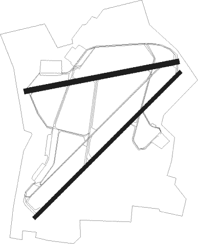
Runway info
Runway 05 / 23  | ||
| length | 2419m (7936ft) | |
| bearing | 59° / 239° | |
| width | 45m (148ft) | |
| surface | asphalt | |
| displ threshold | 137m (449ft) / 217m (712ft) | |
| blast zone | 58m (190ft) / 92m (302ft) | |
| Runway 08 / 26 | ||
| length | 1809m (5935ft) | |
| bearing | 86° / 266° | |
| width | 60m (197ft) | |
| surface | asphalt | |
| displ threshold | 130m (427ft) / 198m (650ft) | |
Nearby beacons
| code | identifier | dist | bearing | frequency |
|---|---|---|---|---|
| CNA | COGNAC CHATEAUBERNARD VOR/DME | 0.2 | 77° | 114.65 |
| CGC | COGNAC CHATEAUBERNARD TACAN | 0.4 | 72° | 116.20 |
| OC | COGNAC NDB | 8.2 | 62° | 346 |
| RY | ROYAN NDB | 23.2 | 266° | 427 |
| ROC | ROCHEFORT NDB | 31.2 | 289° | 396 |
| AGO | ANGOULEME NDB | 31.3 | 86° | 404 |
| NB | BORDEAUX NDB | 32.1 | 204° | 361 |
| BD | BORDEAUX NDB | 44.6 | 199° | 393 |
| RL | LA ROCHELLE NDB | 45.1 | 304° | 322 |
| BE | BORDEAUX NDB | 47.4 | 186° | 318 |
| BMC | BORDEAUX MERIGNAC VOR/DME | 52.7 | 206° | 113.75 |
| LMG | LIMOGES VOR/DME | 57 | 83° | 114.50 |
| SAU | SAUVETERRE DE GUYENNE VOR | 59.3 | 170° | 116.80 |
| PX | PERIGUEUX NDB | 59.6 | 112° | 389 |
| LSU | LIMOGES NDB | 60.1 | 85° | 320 |
| POI | POITIERS BIARDS VOR | 61 | 34° | 113.30 |
| BGC | BERGERAC NDB | 64 | 132° | 374 |
Departure and arrival routes
| Transition altitude | 5000ft |
| SID end points | distance | outbound heading | |
|---|---|---|---|
| RW05 | |||
| VELI2E | 45mi | 145° | |
| VAGN2E | 34mi | 182° | |
| BMC2E | 53mi | 206° | |
| ETPA2E | 36mi | 230° | |
| RW23 | |||
| VELI2W | 45mi | 145° | |
| VAGN2W | 34mi | 182° | |
| BMC2W | 53mi | 206° | |
| ETPA2W | 36mi | 230° | |
Instrument approach procedures
| runway | airway (heading) | route (dist, bearing) |
|---|---|---|
| RW05 | BG430 (82°) | BG430 2100ft BG431 (6mi, 246°) IBG05 (3mi, 129°) 2100ft |
| RW05 | BG431 (73°) | BG431 2100ft IBG05 (3mi, 129°) 2100ft |
| RW05 | BG432 (43°) | BG432 2100ft IBG05 (3mi, 310°) 2100ft |
| RNAV | IBG05 2100ft FBG05 (3mi, 59°) 2100ft LFBG (7mi, 57°) 126ft BG433 (4mi, 63°) BG434 (5mi, 310°) BG430 (8mi, 220°) 2100ft | |
| RW23 | BG421 (215°) | BG421 2100ft IBG23 (5mi, 130°) 2100ft |
| RW23 | BG422 (260°) | BG422 2100ft IBG23 (5mi, 310°) 2100ft |
| RNAV | IBG23 2100ft FBG23 (4mi, 239°) 2100ft LFBG (7mi, 241°) 151ft BG423 (4mi, 236°) 2100ft BG424 (5mi, 310°) 2100ft BG421 (15mi, 59°) 2100ft |
Disclaimer
The information on this website is not for real aviation. Use this data with the X-Plane flight simulator only! Data taken with kind consent from X-Plane 12 source code and data files. Content is subject to change without notice.