Biard - Poitiers Biard
Airport details
| Country | France |
| State | Nouvelle-Aquitaine |
| Region | LF |
| Airspace | Bordeaux Ctr |
| Municipality | Biard |
| Elevation | 420ft (128m) |
| Timezone | GMT +1 |
| Coordinates | 46.58750, 0.30667 |
| Magnetic var | |
| Type | land |
| Available since | X-Plane v10.40 |
| ICAO code | LFBI |
| IATA code | PIS |
| FAA code | n/a |
Communication
| Poitiers Biard POITIERS ATIS | 121.780 |
| Poitiers Biard POITIERS Tower | 118.500 |
| Poitiers Biard POITIERS Approach | 134.100 |
| Poitiers Biard Dep | 118.500 |
Approach frequencies
| ILS-cat-I | RW21 | 110.95 | 18.00mi |
| 3° GS | RW21 | 110.95 | 18.00mi |
Nearby Points of Interest:
City walls of Poitiers
-Prefecture hotel of Vienne
-Hôtel Gilbert
-Échevinage, 7 rue Paul-Guillon
-hôtel Fumé
-Poitiers City Hall
-Palace of Poitiers
-Hôtel Jean Beaucé
-Chapelle Saint-Louis de Poitiers
-Hôtel Couturer
-Hôtel Claveurier
-Monastère Saint-Hilaire de la Celle
-Prieuré hospitalier de Poitiers
-Hôtel de Dreux-Brézé
-Abbaye Saint-Benoît de Quinçay
-Abbaye du Pin
-Château-Couvert
-Église Saint-Hilaire de Bignoux
-Dolmen de Laverré
-Château de Bonnivet
-Château de Chiré-en-Montreuil
-Lanterne des morts de Château-Larcher
-Château de Lusignan
-hôtel des abbesses de Sainte-Croix
-Borne milliaire, Cenon-sur-Vienne
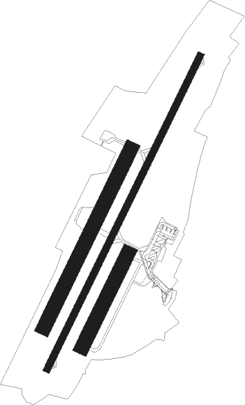
Runway info
Runway 03 / 21  | ||
| length | 2352m (7717ft) | |
| bearing | 41° / 221° | |
| width | 45m (148ft) | |
| surface | asphalt | |
| blast zone | 50m (164ft) / 0m (0ft) | |
| Runway 03R / 21L | ||
| length | 701m (2300ft) | |
| bearing | 41° / 221° | |
| width | 100m (328ft) | |
| surface | grass | |
| displ threshold | 100m (328ft) / 150m (492ft) | |
| Runway 03L / 21R | ||
| length | 1340m (4396ft) | |
| bearing | 40° / 220° | |
| width | 100m (328ft) | |
| surface | grass | |
| displ threshold | 59m (194ft) / 0m (0ft) | |
Nearby beacons
| code | identifier | dist | bearing | frequency |
|---|---|---|---|---|
| POI | POITIERS BIARDS VOR | 0.5 | 233° | 113.30 |
| PI | POITIERS NDB | 8.1 | 41° | 363 |
| AGO | ANGOULEME NDB | 52.8 | 172° | 404 |
| TUR | TOURS VAL DE LOIRE TACAN | 53 | 27° | 113.80 |
| OC | COGNAC NDB | 54.4 | 209° | 346 |
| LMG | LIMOGES VOR/DME | 55.1 | 137° | 114.50 |
| LP | CHOLET NDB | 57.4 | 296° | 357 |
| AMB | AMBOISE NDB | 58.2 | 41° | 341 |
| LSU | LIMOGES NDB | 58.6 | 135° | 320 |
| AMB | AMBOISE VOR/DME | 59.3 | 42° | 113.70 |
| CGC | COGNAC CHATEAUBERNARD TACAN | 61.2 | 214° | 116.20 |
| CNA | COGNAC CHATEAUBERNARD VOR/DME | 61.3 | 214° | 114.65 |
| TUR | TOURS VAL DE LOIRE NDB | 61.8 | 26° | 331 |
| AS | ANGERS NDB | 62.3 | 335° | 392 |
| RL | LA ROCHELLE NDB | 63.2 | 254° | 322 |
| YN | LA ROCHE SUR YON LES AJONCS NDB | 65.9 | 274° | 334 |
| ROC | ROCHEFORT NDB | 68.1 | 242° | 396 |
| ANG | ANGERS VOR | 74.1 | 309° | 113 |
Departure and arrival routes
| Transition altitude | 5000ft |
| SID end points | distance | outbound heading | |
|---|---|---|---|
| RW03 | |||
| AMB5N | 58mi | 41° | |
| OMAR5T, OMAR5N | 41mi | 42° | |
| OLIN5T, OLIN5N | 35mi | 68° | |
| BALA5T, BALA5N | 30mi | 96° | |
| VERA5N, VERA5T | 20mi | 214° | |
| ABSI5T, ABSI5N | 32mi | 270° | |
| GINO5T, GINO5N | 35mi | 348° | |
| RW21 | |||
| AMB5S | 58mi | 41° | |
| OMAR5V, OMAR5S | 41mi | 42° | |
| OLIN5S, OLIN5V | 35mi | 68° | |
| BALA5S, BALA5V | 30mi | 96° | |
| VERA5V, VERA5S | 20mi | 214° | |
| ABSI5V, ABSI5S | 32mi | 270° | |
| GINO5S, GINO5V | 35mi | 348° | |
| STAR starting points | distance | inbound heading | |
|---|---|---|---|
| ALL | |||
| VERAC5 | 19.7 | 34° | |
| ABSI5A, ABSI5B | 31.5 | 90° | |
| GINO5A, GINO5B | 35.1 | 168° | |
| OMARI5 | 40.7 | 222° | |
| OLIN5B, OLIN5A | 35.3 | 248° | |
| BALA5B, BALA5A | 30.3 | 276° | |
| RW03 | |||
| VERA5G | 19.7 | 34° | |
| ABSI5G | 31.5 | 90° | |
| GINO5G | 35.1 | 168° | |
| OMAR5G | 40.7 | 222° | |
| OLIN5G | 35.3 | 248° | |
| BALA5G | 30.3 | 276° | |
| PI5G | 190.8 | 338° | |
| RW21 | |||
| VERA5H | 19.7 | 34° | |
| ABSI5H | 31.5 | 90° | |
| GINO5H | 35.1 | 168° | |
| OMAR5H | 40.7 | 222° | |
| OLIN5H | 35.3 | 248° | |
| BALA5H | 30.3 | 276° | |
Instrument approach procedures
| runway | airway (heading) | route (dist, bearing) |
|---|---|---|
| RW03 | BI032 (89°) | BI032 BI034 (8mi, 180°) 3000ft IBI03 (4mi, 112°) 3000ft |
| RW03 | BI033 (17°) | BI033 3000ft IBI03 (4mi, 292°) 3000ft |
| RW03 | BI034 (59°) | BI034 3000ft IBI03 (4mi, 112°) 3000ft |
| RNAV | IBI03 3000ft FBI03 (3mi, 40°) 3000ft LFBI (9mi, 40°) 466ft PI (8mi, 41°) 2000ft BI031 (9mi, 146°) 4500ft BI033 (15mi, 235°) 3000ft | |
| RW21 | BI210 (221°) | BI210 IBI21 (11mi, 222°) 3000ft |
| RW21 | BI212 (189°) | BI212 3000ft IBI21 (6mi, 120°) 3000ft |
| RW21 | BI215 (233°) | BI215 3000ft IBI21 (5mi, 258°) 3000ft |
| RW21 | PI (221°) | PI BI211 (6mi, 120°) BI213 (5mi, 55°) 3000ft BI215 (5mi, 340°) 3000ft IBI21 (5mi, 258°) 3000ft |
| RNAV | IBI21 3000ft FBI21 (3mi, 221°) 3000ft LFBI (9mi, 221°) 470ft BI220 (2mi, 220°) 2000ft BI211 (11mi, 71°) BI213 (5mi, 55°) 3000ft BI215 (5mi, 340°) 3000ft |
Holding patterns
| STAR name | hold at | type | turn | heading* | altitude | leg | speed limit |
|---|---|---|---|---|---|---|---|
| ABSI5A | PI | FIX | right | 31 (211)° | 3000ft - 6000ft | 1.0min timed | 220 |
| ABSI5B | POI | NDB | left | 206 (26)° | 19500ft - 50000ft | 1.5min timed | ICAO rules |
| ABSI5G | BI032 | VHF | right | 360 (180)° | 3000ft - 4500ft | 1.0min timed | 200 |
| BALA5A | PI | FIX | right | 31 (211)° | 3000ft - 6000ft | 1.0min timed | 220 |
| BALA5B | POI | NDB | left | 206 (26)° | 19500ft - 50000ft | 1.5min timed | ICAO rules |
| GINO5A | PI | FIX | right | 31 (211)° | 3000ft - 6000ft | 1.0min timed | 220 |
| GINO5B | POI | NDB | left | 206 (26)° | 19500ft - 50000ft | 1.5min timed | ICAO rules |
| GINO5G | BI032 | VHF | right | 360 (180)° | 3000ft - 4500ft | 1.0min timed | 200 |
| OLIN5A | PI | FIX | right | 31 (211)° | 3000ft - 6000ft | 1.0min timed | 220 |
| OLIN5B | POI | NDB | left | 206 (26)° | 19500ft - 50000ft | 1.5min timed | ICAO rules |
| OMARI5 | PI | FIX | right | 31 (211)° | 3000ft - 6000ft | 1.0min timed | 220 |
| PI5G | PI | FIX | right | 31 (211)° | 3000ft - 6000ft | 1.0min timed | 220 |
| VERAC5 | PI | FIX | right | 31 (211)° | 3000ft - 6000ft | 1.0min timed | 220 |
| VERAC5 | POI | NDB | left | 206 (26)° | 19500ft - 50000ft | 1.5min timed | ICAO rules |
| *) magnetic outbound (inbound) holding course | |||||||
Disclaimer
The information on this website is not for real aviation. Use this data with the X-Plane flight simulator only! Data taken with kind consent from X-Plane 12 source code and data files. Content is subject to change without notice.