Saint-junien - Saint Junien
Airport details
| Country | France |
| State | Nouvelle-Aquitaine |
| Region | LF |
| Airspace | Bordeaux Ctr |
| Municipality | Saint-Junien |
| Elevation | 899ft (274m) |
| Timezone | GMT +1 |
| Coordinates | 45.90250, 0.91889 |
| Magnetic var | |
| Type | land |
| Available since | X-Plane v10.40 |
| ICAO code | LFBJ |
| IATA code | n/a |
| FAA code | n/a |
Communication
| Saint Junien CTAF | 123.500 |
Nearby Points of Interest:
Collégiale Saint-Junien
-Lantern of the Dead of Cognac-la-Forêt
-Pont-colombier (Veyrac)
-Croix hosannière de Montrol-Sénard
-Couvent des Augustins de Mortemart
-Couvent des Carmes de Mortemart
-dolmen de la Tamanie
-Église Saint-Pierre-ès-Liens de Texon
-Manoir des comtes de Confolens
-château de Boisse
-Pont des Graules
-Colombier de la Ribière
-Atelier de sculpture-marbrerie Boirlaud
-Visitation de Limoges
-hôtel de préfecture de la Haute-Vienne
-Halles de Limoges
-Couvent des Filles-Notre-Dame de Limoges
-Présidial de la généralité du Limousin
-Intendance du Limousin
-Hôtel Estienne de la Rivière
-Hôtel Maledent de Savignac de Feytiat
-Hôtel Bourdeau de Lajudie
-Hôtel Naurissart
-Siège du cercle de l'Union et Turgot de Limoges
-Cité administrative Blanqui
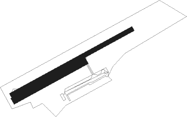
Runway info
Runway 07 / 25  | ||
| length | 586m (1923ft) | |
| bearing | 72° / 252° | |
| width | 20m (66ft) | |
| surface | asphalt | |
| Runway 07R / 25L | ||
| length | 336m (1102ft) | |
| bearing | 72° / 252° | |
| width | 30m (98ft) | |
| surface | grass | |
Nearby beacons
| code | identifier | dist | bearing | frequency |
|---|---|---|---|---|
| LMG | LIMOGES VOR/DME | 6.8 | 129° | 114.50 |
| LSU | LIMOGES NDB | 10.6 | 123° | 320 |
| LOE | LIMOGES NDB | 19.1 | 73° | 424 |
| AGO | ANGOULEME NDB | 23.5 | 249° | 404 |
| PX | PERIGUEUX NDB | 44.2 | 180° | 389 |
| OC | COGNAC NDB | 46.2 | 261° | 346 |
| POI | POITIERS BIARDS VOR | 48.2 | 318° | 113.30 |
| PI | POITIERS NDB | 52.6 | 327° | 363 |
| CGC | COGNAC CHATEAUBERNARD TACAN | 53.3 | 259° | 116.20 |
| CNA | COGNAC CHATEAUBERNARD VOR/DME | 53.5 | 259° | 114.65 |
| BSC | SOUILLAC (BRIVE) NDB | 62 | 142° | 351 |
Disclaimer
The information on this website is not for real aviation. Use this data with the X-Plane flight simulator only! Data taken with kind consent from X-Plane 12 source code and data files. Content is subject to change without notice.