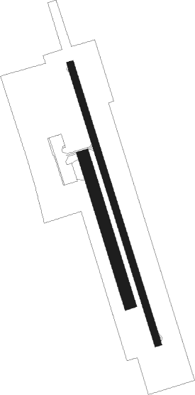
Lépaud - Montlucon Gueret
Airport details
| Country | France |
| State | Nouvelle-Aquitaine |
| Region | LF |
| Airspace | Bordeaux Ctr |
| Municipality | Lépaud |
| Elevation | 1497ft (456m) |
| Timezone | GMT +1 |
| Coordinates | 46.22609, 2.36282 |
| Magnetic var | |
| Type | land |
| Available since | X-Plane v10.40 |
| ICAO code | LFBK |
| IATA code | MCU |
| FAA code | n/a |
Communication
| Montlucon Gueret AFIS | 118.400 |
| Montlucon Gueret Dep | 118.400 |
Nearby Points of Interest:
thermes romains d'Évaux-les-Bains
-Commanderie de Lavaufranche
-Abbaye de Bonlieu
-Chapelle Saint-Rémy de Saint-Sauvier
-Gare de Néris-les-Bains
-Casino de Néris-les-Bains
-Établissement thermal de Néris-les-Bains
-Néris-les-Bains amphitheatre
-Abbaye des Ternes
-pigeonnier-chapelle de La Chaze
-Château de Saint-Maixant
-Lanterne des Morts d'Estivareilles
-Château de la Chezotte
-Maison des Vallenet
-Église Saint-Jean de la Cour
-Château du Théret
-Abbaye de Bussières-les-Nonains
-Petit Théâtre de Guéret
-Hôtel des Moneyroux
-Présidial de Guéret
-menhirs de Barbouly
-Maison Grégueil
-Prieuré Saint-Étienne de Châteaumeillant
-Château d'Arfeuille
-Tour de Felletin

Nearby beacons
| code | identifier | dist | bearing | frequency |
|---|---|---|---|---|
| LPD | MONTLUCON-GUERET NDB | 4.7 | 341° | 398 |
| CFA | CLERMONT FERRAND AUVERGNE VOR/DME | 43.4 | 118° | 114.35 |
| AV | AVORD NDB | 45.7 | 41° | 306 |
| BRG | BOURGES NDB | 47.6 | 354° | 375 |
| CTX | CHATEAUROUX DEOLS NDB | 48.5 | 322° | 428 |
| ASM | CLERMONT-FERRAND/AUVERGNE NDB | 48.7 | 113° | 367 |
| AVD | AVORD TACAN | 51.1 | 18° | 110.60 |
| NV | NEVERS NDB | 55.5 | 49° | 394 |
| AVD | AVORD NDB | 56.6 | 26° | 288 |
| NEV | NEVERS VOR | 60.3 | 31° | 113.40 |
Departure and arrival routes
| Transition altitude | 5000ft |
| STAR starting points | distance | inbound heading | |
|---|---|---|---|
| RW17 | |||
| GUSO1W | 39.5 | 106° | |
Instrument approach procedures
| runway | airway (heading) | route (dist, bearing) |
|---|---|---|
| RW17 | BK414 (117°) | BK414 4700ft BK412 (8mi, 96°) 4700ft IBK17 (6mi, 96°) 3300ft |
| RW17 | LPD (161°) | LPD BK402 (3mi, 273°) 3300ft BK404 (5mi, 342°) IBK17 (3mi, 81°) 3300ft |
| RW17 | RISUN (240°) | RISUN 3300ft BK416 (8mi, 284°) IBK17 (5mi, 262°) 3300ft |
| RNAV | IBK17 3300ft FBK17 (5mi, 162°) 3000ft LFBK (5mi, 162°) 1395ft BK410 (2mi, 162°) LPD (6mi, 342°) LPD (turn) |
Disclaimer
The information on this website is not for real aviation. Use this data with the X-Plane flight simulator only! Data taken with kind consent from X-Plane 12 source code and data files. Content is subject to change without notice.