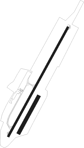
Limoges/bellegarde - Limoges Bellegarde
Airport details
| Country | France |
| State | Nouvelle-Aquitaine |
| Region | LF |
| Airspace | Bordeaux Ctr |
| Municipality | Limoges |
| Elevation | 1295ft (395m) |
| Timezone | GMT +1 |
| Coordinates | 45.85900, 1.17461 |
| Magnetic var | |
| Type | land |
| Available since | X-Plane v10.40 |
| ICAO code | LFBL |
| IATA code | LIG |
| FAA code | n/a |
Communication
| Limoges Bellegarde ATIS | 128.075 |
| Limoges Bellegarde LIMOGES INFO | 124.050 |
| Limoges Bellegarde LIMOGES Tower | 119.550 |
| Limoges Bellegarde LIMOGES Approach | 118.075 |
| Limoges Bellegarde LIMOGES Departure | 119.550 |
Approach frequencies
| ILS-cat-III | RW21 | 110.1 | 18.00mi |
| 3° GS | RW21 | 110.1 | 18.00mi |
Nearby Points of Interest:
Pont-colombier (Veyrac)
-Atelier de sculpture-marbrerie Boirlaud
-Visitation de Limoges
-hôtel de préfecture de la Haute-Vienne
-Halles de Limoges
-Couvent des Filles-Notre-Dame de Limoges
-Intendance du Limousin
-Présidial de la généralité du Limousin
-Hôtel Estienne de la Rivière
-Hôtel Maledent de Savignac de Feytiat
-Hôtel Naurissart
-Hôtel Bourdeau de Lajudie
-Siège du cercle de l'Union et Turgot de Limoges
-Cité administrative Blanqui
-Hôpital municipal de Limoges
-Croix de Beaune-les-Mines
-château de Boisse
-Lantern of the Dead of Cognac-la-Forêt
-Église Saint-Pierre-ès-Liens de Texon
-Pont des Graules
-Colombier de la Ribière
-Collégiale Saint-Junien
-Grange de Coudier
-Croix hosannière de Montrol-Sénard
-tour du Mazet

Nearby beacons
| code | identifier | dist | bearing | frequency |
|---|---|---|---|---|
| LSU | LIMOGES NDB | 5.4 | 222° | 320 |
| LMG | LIMOGES VOR/DME | 6.7 | 254° | 114.50 |
| LOE | LIMOGES NDB | 12.3 | 44° | 424 |
| AGO | ANGOULEME NDB | 32.5 | 259° | 404 |
| PX | PERIGUEUX NDB | 43 | 201° | 389 |
| BSC | SOUILLAC (BRIVE) NDB | 55.2 | 153° | 351 |
| POI | POITIERS BIARDS VOR | 56.6 | 309° | 113.30 |
| PI | POITIERS NDB | 59.9 | 318° | 363 |
| CGC | COGNAC CHATEAUBERNARD TACAN | 63.2 | 262° | 116.20 |
| CNA | COGNAC CHATEAUBERNARD VOR/DME | 63.4 | 262° | 114.65 |
Departure and arrival routes
| Transition altitude | 5000ft |
| SID end points | distance | outbound heading | |
|---|---|---|---|
| RW03 | |||
| LARO3A, LARO2E | 48mi | 70° | |
| ROA2E | 119mi | 86° | |
| MAKO2E, MAKO3A | 32mi | 173° | |
| PERI3A, PERI2E | 45mi | 195° | |
| NORO3A, NORO2E | 31mi | 233° | |
| BALA3A, BALA2E | 40mi | 348° | |
| RW21 | |||
| LARO3B, LARO2W | 48mi | 70° | |
| ROA2W | 119mi | 86° | |
| MAKO2W | 32mi | 173° | |
| PERI2W | 45mi | 195° | |
| NORO2W | 31mi | 233° | |
| BALA3B, BALA2W | 40mi | 348° | |
| STAR starting points | distance | inbound heading | |
|---|---|---|---|
| ALL | |||
| MAKO2L | 19.8 | 4° | |
| PERI2N | 45.3 | 15° | |
| PERI2L | 21.8 | 27° | |
| NORO2L, NORO2N | 24.0 | 55° | |
| MAKO2N | 31.7 | 353° | |
| RW03 | |||
| PERI3M | 45.3 | 15° | |
| NORO3M | 30.6 | 53° | |
| BALA3M | 39.8 | 168° | |
| GUSO3M | 39.0 | 206° | |
| GUER3M | 43.0 | 250° | |
| MAKO3M | 31.7 | 353° | |
| RW21 | |||
| PERI3R | 45.3 | 15° | |
| NORO3R | 30.6 | 53° | |
| BALA3R, BALA2N | 39.8 | 168° | |
| GUSO2N, GUSO3R | 39.0 | 206° | |
| GUER3R | 43.0 | 250° | |
| MAKO3R | 31.7 | 353° | |
Instrument approach procedures
| runway | airway (heading) | route (dist, bearing) |
|---|---|---|
| RW03 | MIGRA (42°) | MIGRA 3700ft FBL03 (5mi, 43°) 3700ft |
| RW03 | NERTI (60°) | NERTI 3700ft MIGRA (5mi, 99°) 3700ft FBL03 (5mi, 43°) 3700ft |
| RW03 | SOLNO (14°) | SOLNO 3700ft MIGRA (6mi, 303°) 3700ft FBL03 (5mi, 43°) 3700ft |
| RNAV | FBL03 3700ft LFBL (8mi, 42°) 1322ft BL410 (2mi, 48°) 3700ft MIGRA (14mi, 223°) 3700ft MIGRA (turn) 4700ft | |
| RW21 | BL502 (198°) | BL502 4000ft IBL21 (5mi, 115°) 4000ft FBL21 (4mi, 223°) 4000ft |
| RW21 | BL504 (244°) | BL504 4000ft IBL21 (5mi, 295°) 4000ft FBL21 (4mi, 223°) 4000ft |
| RW21 | IBL21 (224°) | IBL21 4000ft FBL21 (4mi, 223°) 4000ft |
| RNAV | FBL21 4000ft LFBL (9mi, 224°) 1324ft BL512 (1mi, 215°) 4000ft IBL21 (14mi, 43°) 4000ft IBL21 (turn) 4000ft |
Holding patterns
| STAR name | hold at | type | turn | heading* | altitude | leg | speed limit |
|---|---|---|---|---|---|---|---|
| BALA2N | LOE | FIX | left | 33 (213)° | 4000ft - 10000ft | 1.0min timed | 210 |
| GUER2N | LOE | FIX | left | 33 (213)° | 4000ft - 10000ft | 1.0min timed | 210 |
| GUSO2N | LOE | FIX | left | 33 (213)° | 4000ft - 10000ft | 1.0min timed | 210 |
| MAKO2L | LECAR | VHF | right | 183 (3)° | 3700ft - 10000ft | DME 5.0mi | 210 |
| MAKO2N | LOE | FIX | left | 33 (213)° | 4000ft - 10000ft | 1.0min timed | 210 |
| NORO2L | LECAR | VHF | right | 183 (3)° | 3700ft - 10000ft | DME 5.0mi | 210 |
| NORO2N | LOE | FIX | left | 33 (213)° | 4000ft - 10000ft | 1.0min timed | 210 |
| PERI2L | LECAR | VHF | right | 183 (3)° | 3700ft - 10000ft | DME 5.0mi | 210 |
| PERI2N | LECAR | VHF | right | 183 (3)° | 3700ft - 10000ft | DME 5.0mi | 210 |
| PERI2N | LOE | FIX | left | 33 (213)° | 4000ft - 10000ft | 1.0min timed | 210 |
| *) magnetic outbound (inbound) holding course | |||||||
Disclaimer
The information on this website is not for real aviation. Use this data with the X-Plane flight simulator only! Data taken with kind consent from X-Plane 12 source code and data files. Content is subject to change without notice.