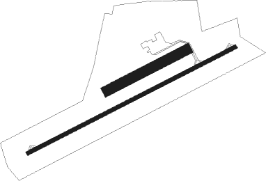
Niort/souché - Niort Marais Poitevin
Airport details
| Country | France |
| State | Nouvelle-Aquitaine |
| Region | LF |
| Airspace | Bordeaux Ctr |
| Municipality | Niort |
| Elevation | 201ft (61m) |
| Timezone | GMT +1 |
| Coordinates | 46.31342, -0.39443 |
| Magnetic var | |
| Type | land |
| Available since | X-Plane v10.40 |
| ICAO code | LFBN |
| IATA code | NIT |
| FAA code | n/a |
Communication
| Niort Marais Poitevin NIORT INFO | 119.100 |
| Niort Marais Poitevin COGNAC Approach | 122.550 |
Nearby Points of Interest:
Prefecture hotel of Deux-Sèvres
-Prieuré de Saint-Médard (Deux-Sèvres)
-Église Saint-Léger de Saint-Maixent-l'École
-Temple protestant de Beaussais
-Marais Poitevin
-Péré tumulus
-Château de Chassenon
-Château de la Baugisière
-Croix hosannière de Ménigoute
-Prieuré Notre-Dame-d'Oulmes
-Gallo-Roman amphitheatre of Sanxay
-Moulin de La Roche
-Caserne Belliard
-Hôtel Pervinquière
-Maison Louis XV
-pont des Ouillères
-Hôtel de la Sénéchaussée
-Maison Billaud
-Place Belliard
-Hôtel des évêques de Maillezais
-Hôtel dit Château-Gaillard
-Maison de François Viète
-Prieuré Notre-Dame de Fontenay-le-Comte
-Église Saint-Paul de Parthenay
-logis des Varennes
Nearby beacons
| code | identifier | dist | bearing | frequency |
|---|---|---|---|---|
| RL | LA ROCHELLE NDB | 30.4 | 259° | 322 |
| POI | POITIERS BIARDS VOR | 32.8 | 69° | 113.30 |
| ROC | ROCHEFORT NDB | 35.4 | 234° | 396 |
| OC | COGNAC NDB | 35.7 | 158° | 346 |
| CGC | COGNAC CHATEAUBERNARD TACAN | 39.3 | 172° | 116.20 |
| CNA | COGNAC CHATEAUBERNARD VOR/DME | 39.4 | 173° | 114.65 |
| PI | POITIERS NDB | 40.5 | 64° | 363 |
| YN | LA ROCHE SUR YON LES AJONCS NDB | 43.2 | 293° | 334 |
| RY | ROYAN NDB | 46.3 | 214° | 427 |
| AGO | ANGOULEME NDB | 49.8 | 126° | 404 |
| LP | CHOLET NDB | 52.6 | 332° | 357 |
| LMG | LIMOGES VOR/DME | 66.2 | 109° | 114.50 |
| LSU | LIMOGES NDB | 70.1 | 109° | 320 |
| LOE | LIMOGES NDB | 74 | 99° | 424 |
Instrument approach procedures
| runway | airway (heading) | route (dist, bearing) |
|---|---|---|
| RW25 | NIGAG (296°) | NIGAG 2500ft NIPLO (9mi, 74°) NITUB (5mi, 329°) 2500ft |
| RW25 | NIPLO (270°) | NIPLO 2500ft NITUB (5mi, 329°) 2500ft |
| RW25 | NIRAP (235°) | NIRAP 2500ft NITUB (5mi, 149°) 2500ft |
| RNAV | NITUB 2500ft BN408 (5mi, 254°) 2500ft LFBN (7mi, 254°) 250ft BN410 (3mi, 254°) NIGAG (8mi, 102°) 2500ft |
Disclaimer
The information on this website is not for real aviation. Use this data with the X-Plane flight simulator only! Data taken with kind consent from X-Plane 12 source code and data files. Content is subject to change without notice.

