Muret - Biscarosse Parentis
Airport details
| Country | France |
| State | Nouvelle-Aquitaine |
| Region | LF |
| Airspace | Bordeaux Ctr |
| Municipality | Biscarrosse |
| Elevation | 328ft (100m) |
| Timezone | GMT +1 |
| Coordinates | 44.36806, -1.13222 |
| Magnetic var | |
| Type | land |
| Available since | X-Plane v10.40 |
| ICAO code | LFBS |
| IATA code | n/a |
| FAA code | n/a |
Communication
| Biscarosse Parentis Tower | 118.950 |
Nearby Points of Interest:
Église Saint-Martin de Pontenx-les-Forges
-Villa Thérésa (Arcachon)
-Monument aux morts d'Arcachon
-Domaine de Certes
-forges d'Uza
-Atelier des Chemins de fer économiques de la Gironde
-Chapelle Notre-Dame-d'Arosse
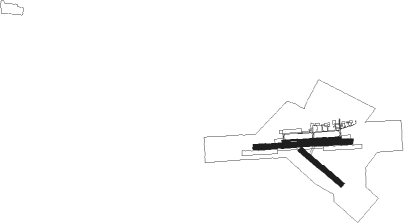
Runway info
Runway 09 / 27  | ||
| length | 799m (2621ft) | |
| bearing | 91° / 271° | |
| width | 20m (66ft) | |
| surface | asphalt | |
| Runway 09R / 27L | ||
| length | 1312m (4304ft) | |
| bearing | 91° / 271° | |
| width | 71m (234ft) | |
| surface | grass | |
| blast zone | 0m (0ft) / 66m (217ft) | |
| Runway 14 / 32 | ||
| length | 712m (2336ft) | |
| bearing | 125° / 305° | |
| width | 72m (235ft) | |
| surface | grass | |
| blast zone | 0m (0ft) / 107m (351ft) | |
| Runway 01 / 19 | ||
| length | 2768m (9081ft) | |
| bearing | 352° / 172° | |
| width | 1000m (3281ft) | |
Nearby beacons
| code | identifier | dist | bearing | frequency |
|---|---|---|---|---|
| BRS | BISCARROSSE NDB | 0.2 | 127° | 358 |
| CAA | CAZAUX TACAN | 9.7 | 359° | 110.80 |
| CAA | CAZAUX NDB | 11 | 4° | 382 |
| BMC | BORDEAUX MERIGNAC VOR/DME | 32.6 | 42° | 113.75 |
| MDM | MARSAN (MONT-DE-MARSAN) TACAN | 38.5 | 126° | 108.70 |
| LGH | MARSAN (MONT-DE-MARSAN) VOR/DME | 38.8 | 126° | 111.65 |
| DX | DAX SEYRESSE NDB | 40.5 | 171° | 334 |
| BD | BORDEAUX NDB | 41.8 | 45° | 393 |
| BE | BORDEAUX NDB | 43.5 | 56° | 318 |
| SAU | SAUVETERRE DE GUYENNE VOR | 45.8 | 73° | 116.80 |
| NB | BORDEAUX NDB | 52.9 | 37° | 361 |
| BZ | BIARRITZ PAYS BASQUE NDB | 55.1 | 197° | 341 |
| BTZ | BIARRITZ PAYS BASQUE VOR/DME | 56.5 | 203° | 114.15 |
| HIG | SAN SEBASTIAN NDB | 65.5 | 214° | 328 |
Instrument approach procedures
| runway | airway (heading) | route (dist, bearing) |
|---|---|---|
| RW27-X | BRS (307°) | BRS BS274 (7mi, 124°) BS272 (3mi, 91°) 2000ft IBS27 (5mi, 1°) 2000ft |
| RW27-X | BS271 (248°) | BS271 2000ft IBS27 (5mi, 182°) 2000ft |
| RW27-X | BS272 (294°) | BS272 2000ft IBS27 (5mi, 1°) 2000ft |
| RW27-X | LAPOS (276°) | LAPOS IBS27 (4mi, 289°) 2000ft |
| RNAV | IBS27 2000ft FBS27 (3mi, 271°) 2000ft MBS27 (5mi, 271°) 244ft BS270 (5mi, 181°) BS272 (8mi, 91°) 2000ft | |
| RW27-Y | BRS (307°) | BRS BS274 (7mi, 124°) BS272 (3mi, 91°) 2000ft IBS27 (5mi, 1°) 2000ft |
| RW27-Y | BS271 (248°) | BS271 2000ft IBS27 (5mi, 182°) 2000ft |
| RW27-Y | BS272 (294°) | BS272 2000ft IBS27 (5mi, 1°) 2000ft |
| RW27-Y | LAPOS (276°) | LAPOS IBS27 (4mi, 289°) 2000ft |
| RNAV | IBS27 2000ft FBS27 (3mi, 271°) 2000ft LFBS (5mi, 271°) 138ft BS270 (5mi, 173°) BS272 (8mi, 91°) 2000ft | |
| RW27-Z | BRS (307°) | BRS BS274 (7mi, 124°) BS272 (3mi, 91°) 2000ft IBS27 (5mi, 1°) 2000ft |
| RW27-Z | BS271 (248°) | BS271 2000ft IBS27 (5mi, 182°) 2000ft |
| RW27-Z | BS272 (294°) | BS272 2000ft IBS27 (5mi, 1°) 2000ft |
| RW27-Z | LAPOS (276°) | LAPOS IBS27 (4mi, 289°) 2000ft |
| RNAV | IBS27 2000ft FBS27 (3mi, 271°) 2000ft LFBS (5mi, 271°) 138ft BS27Z (turn) BS270 (5mi, 168°) BS272 (8mi, 91°) 2000ft |
Disclaimer
The information on this website is not for real aviation. Use this data with the X-Plane flight simulator only! Data taken with kind consent from X-Plane 12 source code and data files. Content is subject to change without notice.