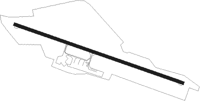
Périgueux/bassillac - Perigueux Bassillac
Airport details
| Country | France |
| State | Nouvelle-Aquitaine |
| Region | LF |
| Airspace | Bordeaux Ctr |
| Municipality | Bassillac et Auberoche |
| Elevation | 328ft (100m) |
| Timezone | GMT +1 |
| Coordinates | 45.19749, 0.81522 |
| Magnetic var | |
| Type | land |
| Available since | X-Plane v10.40 |
| ICAO code | LFBX |
| IATA code | PGX |
| FAA code | n/a |
Communication
| Perigueux Bassillac PERIGUEUX INFO | 118.775 |
| Perigueux Bassillac AQUITAINE Approach | 119.275 |
Nearby Points of Interest:
Guinguette Barnabé
-Centre hospitalier de Périgueux
-Hôtel de Fayolle (Périgueux)
-Hôtel de la Monnaie, Périgueux
-Hôtel de Nervau
-Logis Gamanson
-Maison du Thouin (Périgueux)
-Hôtel Brou de Laurière
-Hôtel d'Abzac de La Douze
-Maison Estignard (Périgueux)
-Hôtel de Lestrade, 1 rue de la Sagesse, Périgueux
-ensemble urbain de Périgueux
-Palais de Justice de Périgueux
-Couvent des Dames de la Foi
-Couvent Sainte-Marthe
-Lanterne des morts d'Atur
-Citadelle gallo-romaine de Vésone
-Forge d'Ans
-Manoir de la Borie-Fricart
-Château de la Valade
-Manoir du Chatenet
-église Saint-Martin de Lisle
-Fourneau-du-Diable
-Manoir de la Peyzie
-Gisement préhistorique de Rochereil
Nearby beacons
| code | identifier | dist | bearing | frequency |
|---|---|---|---|---|
| PX | PERIGUEUX NDB | 4.5 | 108° | 389 |
| BGC | BERGERAC NDB | 24.1 | 207° | 374 |
| AGO | ANGOULEME NDB | 34.8 | 323° | 404 |
| BSC | SOUILLAC (BRIVE) NDB | 36.3 | 104° | 351 |
| LSU | LIMOGES NDB | 37.2 | 26° | 320 |
| LMG | LIMOGES VOR/DME | 38.1 | 19° | 114.50 |
| SAU | SAUVETERRE DE GUYENNE VOR | 51.6 | 242° | 116.80 |
| FC | FIGEAC LIVERNON NDB | 52 | 118° | 395 |
| OC | COGNAC NDB | 52.4 | 299° | 346 |
| LOE | LIMOGES NDB | 54.6 | 32° | 424 |
| CGC | COGNAC CHATEAUBERNARD TACAN | 54.9 | 292° | 116.20 |
| BE | BORDEAUX NDB | 55 | 255° | 318 |
| CL | CAHORS NDB | 55 | 144° | 348 |
| CNA | COGNAC CHATEAUBERNARD VOR/DME | 55 | 292° | 114.65 |
| NB | BORDEAUX NDB | 57.8 | 268° | 361 |
| BD | BORDEAUX NDB | 60.5 | 259° | 393 |
| BMC | BORDEAUX MERIGNAC VOR/DME | 68.9 | 256° | 113.75 |
Instrument approach procedures
| runway | airway (heading) | route (dist, bearing) |
|---|---|---|
| RW29 | BX291 (274°) | BX291 3500ft IBX29 (4mi, 233°) 2300ft |
| RW29 | BX292 (292°) | BX292 4000ft IBX29 (5mi, 301°) 2300ft |
| RW29 | PX (288°) | PX 5000ft BX293 (6mi, 61°) 2300ft BX291 (4mi, 124°) 2300ft IBX29 (4mi, 233°) 2300ft |
| RNAV | IBX29 2300ft FBX29 (4mi, 287°) 2300ft LFBX (6mi, 287°) 373ft BX290 (3mi, 287°) 2300ft BX293 (12mi, 88°) 2300ft BX291 (4mi, 124°) 2300ft |
Disclaimer
The information on this website is not for real aviation. Use this data with the X-Plane flight simulator only! Data taken with kind consent from X-Plane 12 source code and data files. Content is subject to change without notice.