Saint-laurent - Gueret Saint Laurent
Airport details
| Country | France |
| State | Nouvelle-Aquitaine |
| Region | LF |
| Airspace | Bordeaux Ctr |
| Municipality | Saint-Laurent |
| Elevation | 1207ft (368m) |
| Timezone | GMT +1 |
| Coordinates | 46.17556, 1.95306 |
| Magnetic var | |
| Type | land |
| Available since | X-Plane v10.40 |
| ICAO code | LFCE |
| IATA code | n/a |
| FAA code | n/a |
Communication
| Gueret Saint Laurent CTAF | 123.500 |
Nearby Points of Interest:
Château du Théret
-Petit Théâtre de Guéret
-Hôtel des Moneyroux
-Présidial de Guéret
-Abbaye des Ternes
-Château de la Chezotte
-château de Gartempe
-Château de Saint-Maixant
-Abbaye de Bonlieu
-Commanderie de Lavaufranche
-Maison des Vallenet
-Église Saint-Jean de la Cour
-Château des Places
-Tour de Felletin
-Pont Roby
-Château d'Arfeuille
-Chapelle Saint-Rémy de Saint-Sauvier
-Château du Chambon (Bersac-sur-Rivalier)
-Commanderie de Charrières
-Château de Valmate
-thermes romains d'Évaux-les-Bains
-pigeonnier-chapelle de La Chaze
-Église Saint-Martial de Gentioux-Pigerolles
-Manoir de Cluis-Dessus
-Monuments historiques in La Châtre
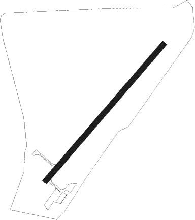
Runway info
| Runway 05 / 23 | ||
| length | 676m (2218ft) | |
| bearing | 56° / 236° | |
| width | 20m (66ft) | |
| surface | asphalt | |
| displ threshold | 150m (492ft) / 0m (0ft) | |
Nearby beacons
| code | identifier | dist | bearing | frequency |
|---|---|---|---|---|
| LPD | MONTLUCON-GUERET NDB | 17.6 | 72° | 398 |
| LOE | LIMOGES NDB | 27 | 257° | 424 |
| LSU | LIMOGES NDB | 42.5 | 245° | 320 |
| LMG | LIMOGES VOR/DME | 44.3 | 249° | 114.50 |
| CTX | CHATEAUROUX DEOLS NDB | 46.1 | 349° | 428 |
| BRG | BOURGES NDB | 52.3 | 21° | 375 |
| AV | AVORD NDB | 58.4 | 54° | 306 |
| AVD | AVORD TACAN | 59.9 | 37° | 110.60 |
| AVD | AVORD NDB | 66.6 | 42° | 288 |
| NEV | NEVERS VOR | 71.1 | 45° | 113.40 |
Disclaimer
The information on this website is not for real aviation. Use this data with the X-Plane flight simulator only! Data taken with kind consent from X-Plane 12 source code and data files. Content is subject to change without notice.