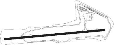
Albi/le Séquestre - Le Sequestre
Airport details
| Country | France |
| State | Occitania |
| Region | LF |
| Airspace | Bordeaux Ctr |
| Municipality | Le Sequestre |
| Elevation | 563ft (172m) |
| Timezone | GMT +1 |
| Coordinates | 43.91328, 2.11675 |
| Magnetic var | |
| Type | land |
| Available since | X-Plane v10.40 |
| ICAO code | LFCI |
| IATA code | LBI |
| FAA code | n/a |
Communication
| Le Sequestre ALBI INFO | 118.950 |
| Le Sequestre TOULOUSE Approach | 123.850 |
| Le Sequestre TOULOUSE Approach | 129.300 |
Nearby Points of Interest:
Hôtel de Rochegude
-Hôtel du Bosc
-Maison au 1 rue Sainte Cécile à Albi
-Hôtel de ville (Albi)
-Tour du Boutge
-Maison, 1 rue des Foissants, Albi
-Maison Enjalbert
-Maison des Viguiers, Albi
-Municipal Theatre of Albi
-Vermicellerie
-Château du Gô
-puits de Campgrand
-Église Notre-Dame-de-l'Assomption de Cadalen
-Centrale électrique de la mine de charbon de Carmaux
-Clinique Sainte-Barbe de Carmaux
-Prison de Gaillac
-Tour de Palmata
-Maison Yversen
-Maison, 13 rue de la Courtade, rue d'Anguille in Gaillac
-Croix d'Ambialet
-Remparts de Cordes-sur-Ciel
-Prieuré d'Ambialet
-Croix des Cabannes
-Château de Meyragues
-Croix de Salvetat
Nearby beacons
| code | identifier | dist | bearing | frequency |
|---|---|---|---|---|
| AB | ALBI NDB | 2.2 | 269° | 323 |
| GAI | GAILLAC VOR | 12.8 | 278° | 115.80 |
| CVU | CASTRES-MAZAMET NDB | 17.3 | 162° | 356 |
| TLB | TOULOUSE NDB | 29.2 | 273° | 368 |
| TOE | TOULOUSE NDB | 32.1 | 225° | 415 |
| ROM | RODEZ NDB | 32.8 | 50° | 302 |
| RZ | RODEZ NDB | 34 | 32° | 387 |
| TS | TOULOUSE NDB | 36.6 | 237° | 423 |
| TOU | TOULOUSE BLAGNAC VOR/DME | 37.6 | 254° | 117.70 |
| CL | CAHORS NDB | 41.4 | 304° | 348 |
| CS | CARCASSONNE SALVAZA NDB | 41.6 | 173° | 345 |
| TLF | FRANCAZAL NDB | 43.6 | 251° | 332 |
| FC | FIGEAC LIVERNON NDB | 47.6 | 336° | 395 |
| MUT | MURET NDB | 48.2 | 245° | 350 |
| PMR | PAMIERS NDB | 54.2 | 212° | 384 |
Departure and arrival routes
| Transition altitude | 5000ft |
| SID end points | distance | outbound heading | |
|---|---|---|---|
| RW09 | |||
| MEN3E | 61mi | 56° | |
| BISB3E | 17mi | 66° | |
| AFRI3E | 34mi | 100° | |
| FINO3E | 12mi | 204° | |
| GAI3E | 13mi | 278° | |
| RW27 | |||
| MEN3W | 61mi | 56° | |
| BISB3W | 17mi | 66° | |
| AFRI3W | 34mi | 100° | |
| FINO3W | 12mi | 204° | |
| GAI3W | 13mi | 278° | |
| STAR starting points | distance | inbound heading | |
|---|---|---|---|
| ALL | |||
| FINO2L | 12.4 | 24° | |
| GAI2L | 12.8 | 98° | |
| MEN2L | 61.3 | 236° | |
| AFRI2L | 33.6 | 280° | |
Instrument approach procedures
| runway | airway (heading) | route (dist, bearing) |
|---|---|---|
| RW09 | CI402 (105°) | CI402 4000ft ICI09 (5mi, 179°) 3500ft |
| RW09 | CI404 (74°) | CI404 4000ft ICI09 (5mi, 359°) 3500ft |
| RW09 | RW09 (90°) | RW09 4000ft CI410 (6mi, 90°) 4000ft CI414 (4mi, 359°) 4000ft CI402 (18mi, 272°) 4000ft ICI09 (5mi, 179°) 3500ft |
| RNAV | ICI09 3500ft FCI09 (5mi, 89°) 3000ft LFCI (8mi, 89°) 602ft CI410 (5mi, 90°) 4000ft CI414 (4mi, 359°) 4000ft CI402 (18mi, 272°) 4000ft | |
| RW27 | CI602 (252°) | CI602 4000ft ICI27 (5mi, 179°) 3500ft |
| RW27 | CI604 (299°) | CI604 4000ft CI605 (5mi, 90°) 3500ft ICI27 (5mi, 359°) 3500ft |
| RW27 | RW27 (270°) | RW27 4000ft CI610 (5mi, 269°) 4000ft CI612 (5mi, 359°) 4000ft CI614 (7mi, 89°) 4000ft CI602 (9mi, 90°) 4000ft ICI27 (5mi, 179°) 3500ft |
| RNAV | ICI27 3500ft FCI27 (5mi, 270°) 3000ft LFCI (6mi, 270°) 613ft CI610 (5mi, 269°) 4000ft CI612 (5mi, 359°) 4000ft CI614 (7mi, 89°) 4000ft CI602 (9mi, 90°) 4000ft |
Holding patterns
| STAR name | hold at | type | turn | heading* | altitude | leg | speed limit |
|---|---|---|---|---|---|---|---|
| AFRI2L | AB | FIX | right | 268 (88)° | 2200ft - 7000ft | 1.0min timed | 190 |
| FINO2L | AB | FIX | right | 268 (88)° | 2200ft - 7000ft | 1.0min timed | 190 |
| GAI2L | AB | FIX | right | 268 (88)° | 2200ft - 7000ft | 1.0min timed | 190 |
| MEN2L | AB | FIX | right | 268 (88)° | 2200ft - 7000ft | 1.0min timed | 190 |
| *) magnetic outbound (inbound) holding course | |||||||
Disclaimer
The information on this website is not for real aviation. Use this data with the X-Plane flight simulator only! Data taken with kind consent from X-Plane 12 source code and data files. Content is subject to change without notice.