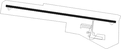
Villeneuve-sur-lot - Villeneuve Sur Lot
Airport details
| Country | France |
| State | Nouvelle-Aquitaine |
| Region | LF |
| Airspace | Bordeaux Ctr |
| Municipality | Villeneuve-sur-Lot |
| Elevation | 188ft (57m) |
| Timezone | GMT +1 |
| Coordinates | 44.39917, 0.75944 |
| Magnetic var | |
| Type | land |
| Available since | X-Plane v10.40 |
| ICAO code | LFCW |
| IATA code | n/a |
| FAA code | n/a |
Communication
| Villeneuve sur Lot CTAF | 123.600 |
| Villeneuve sur Lot Twr | 123.600 |
| Villeneuve sur Lot Dep | 123.600 |
Nearby Points of Interest:
Église Saint-Pierre-ès-Liens de Collongues
-église Saint-Sernin d'Eysses (Villeneuve-sur-Lot)
-Hôpital Saint-Cyr (Villeneuve-sur-Lot)
-Pont de la Libération
-Tour d'Escoute
-Église Saint-Étienne du Mail
-église Notre-Dame de Bias
-Domaine de Senelles
-Château Saint-Sulpice
-Château de Frespech
-Château de Clermont-Soubiran
-église Saint-Jean d'Aygues Vives
-Maison du Prince Noir
-Manoir Cabirol
-Halle de Saint-Pastour
-stade Henri-Cavallier
-église Saint-Barthélemy de Tournon-d'Agenais
-Château du Trichot
-prieuré Saint-Sardos de Laurenque
-Pont sur le Lot de Castelmoron-sur-Lot
-Alignements du Bosc
-Château de Cuzorn
-abbaye de Saint-Maurin
-Tour du Chapelet
-Maison du Sénéchal (Agen)
Nearby beacons
| code | identifier | dist | bearing | frequency |
|---|---|---|---|---|
| AG | AGEN NDB | 15.3 | 199° | 400 |
| BGC | BERGERAC NDB | 25.9 | 342° | 374 |
| CL | CAHORS NDB | 28.1 | 91° | 348 |
| AGN | AGEN VOR/DME | 31 | 167° | 114.80 |
| TLB | TOULOUSE NDB | 40 | 124° | 368 |
| LMT | AUCH NDB | 41.4 | 193° | 420 |
| SAU | SAUVETERRE DE GUYENNE VOR | 42.4 | 287° | 116.80 |
| PX | PERIGUEUX NDB | 46.5 | 11° | 389 |
| TOU | TOULOUSE BLAGNAC VOR/DME | 49.2 | 143° | 117.70 |
| BSC | SOUILLAC (BRIVE) NDB | 51.3 | 55° | 351 |
| TLF | FRANCAZAL NDB | 51.9 | 151° | 332 |
| TW | TOULOUSE NDB | 53.4 | 163° | 406 |
| BE | BORDEAUX NDB | 56.9 | 292° | 318 |
| MUT | MURET NDB | 58.1 | 155° | 350 |
| LGH | MARSAN (MONT-DE-MARSAN) VOR/DME | 61.4 | 249° | 111.65 |
| MDM | MARSAN (MONT-DE-MARSAN) TACAN | 61.8 | 249° | 108.70 |
| TS | TOULOUSE NDB | 62.1 | 141° | 423 |
| BD | BORDEAUX NDB | 64.9 | 292° | 393 |
| LMB | LEMBEYE VOR | 65.3 | 220° | 111.80 |
| TOE | TOULOUSE NDB | 68 | 135° | 415 |
| BMC | BORDEAUX MERIGNAC VOR/DME | 68.3 | 286° | 113.75 |
| NB | BORDEAUX NDB | 71.6 | 300° | 361 |
Disclaimer
The information on this website is not for real aviation. Use this data with the X-Plane flight simulator only! Data taken with kind consent from X-Plane 12 source code and data files. Content is subject to change without notice.