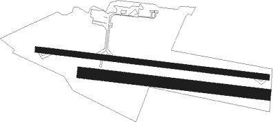
Royan/médis - Royan Medis
Airport details
| Country | France |
| State | Nouvelle-Aquitaine |
| Region | LF |
| Airspace | Bordeaux Ctr |
| Municipality | Médis |
| Elevation | 69ft (21m) |
| Timezone | GMT +1 |
| Coordinates | 45.63116, -0.97549 |
| Magnetic var | |
| Type | land |
| Available since | X-Plane v10.40 |
| ICAO code | LFCY |
| IATA code | RYN |
| FAA code | n/a |
Communication
| Royan Medis ROYAN INFO | 118.800 |
| Royan Medis AQUITAINE Approach | 118.600 |
Nearby Points of Interest:
Villa Aigue-Marine
-palais des Congrès de Royan
-Pierre Levée de Berthegrille
-Halles de Cozes
-Le Fâ
-Halles de Pisany
-Prieuré de Sainte-Gemme
-Halle de Saint-Jean-d'Angle
-batterie Muschel
-Logis de Vallade
-Prieuré de Pont-l'Abbé-d'Arnoult
-Hôtel de Brémond d'Ars
-Ancien couvent des Jacobins de Saintes
-haras national de Saintes
-Éolienne du Clône
-Hospice of Soubise
-Hôtel de Cheusses
-hôtel Kerlivio-Broussard
-Arsenal de Rochefort
-Château du Fa
-Caserne Latouche-Tréville
-Magasin aux vivres de Rochefort
-Hôpital de la marine
-Fortifications de Rochefort
-Abbatiale de Saint-Savinien

Nearby beacons
| code | identifier | dist | bearing | frequency |
|---|---|---|---|---|
| RY | ROYAN NDB | 4.6 | 98° | 427 |
| ROC | ROCHEFORT NDB | 15.4 | 358° | 396 |
| CNA | COGNAC CHATEAUBERNARD VOR/DME | 27.9 | 88° | 114.65 |
| CGC | COGNAC CHATEAUBERNARD TACAN | 28 | 87° | 116.20 |
| RL | LA ROCHELLE NDB | 33.1 | 347° | 322 |
| NB | BORDEAUX NDB | 34.1 | 139° | 361 |
| OC | COGNAC NDB | 34.7 | 82° | 346 |
| BD | BORDEAUX NDB | 45.2 | 149° | 393 |
| BMC | BORDEAUX MERIGNAC VOR/DME | 49.4 | 162° | 113.75 |
| BE | BORDEAUX NDB | 51.7 | 143° | 318 |
| AGO | ANGOULEME NDB | 59 | 87° | 404 |
| SAU | SAUVETERRE DE GUYENNE VOR | 67 | 139° | 116.80 |
Instrument approach procedures
| runway | airway (heading) | route (dist, bearing) |
|---|---|---|
| RW28 | CY281 (262°) | CY281 ICY28 (4mi, 196°) 2000ft |
| RW28 | CY282 (295°) | CY282 ICY28 (4mi, 16°) 2000ft |
| RW28 | RY (278°) | RY CY284 (5mi, 166°) 2000ft CY282 (3mi, 94°) ICY28 (4mi, 16°) 2000ft |
| RNAV | ICY28 2000ft FCY28 (3mi, 278°) 2000ft LFCY (6mi, 278°) 121ft RY (5mi, 98°) 2000ft RY (turn) 2000ft |
Disclaimer
The information on this website is not for real aviation. Use this data with the X-Plane flight simulator only! Data taken with kind consent from X-Plane 12 source code and data files. Content is subject to change without notice.