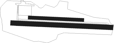
Saint-pierre-d'oléron - Saint Pierre D'oleron
Airport details
| Country | France |
| State | Nouvelle-Aquitaine |
| Region | LF |
| Airspace | Bordeaux Ctr |
| Municipality | Saint-Pierre-d'Oléron |
| Elevation | 20ft (6m) |
| Timezone | GMT +1 |
| Coordinates | 45.95778, -1.31139 |
| Magnetic var | |
| Type | land |
| Available since | X-Plane v10.40 |
| ICAO code | LFDP |
| IATA code | n/a |
| FAA code | n/a |
Communication
Nearby Points of Interest:
maison des aïeules de Pierre Loti
-Maison Heureuse de Saint-Georges-d'Oléron
-Église Saint-André de Dolus-d'Oléron
-maison Gourgaud
-caserne Montalembert
-maisons Gourgaud
-Maison de l'Empereur
-Fort Enet
-Villa La Jetée
-Hospice of Soubise
-Slipway
-Villa Alsace, La Rochelle
-Porte des deux moulins de la rochelle
-bastion du Gabut
-Vieux-Port de La Rochelle
-Prefecture hotel of Charente-Maritime
-Église des Carmes
-Maison Pillaud
-La Rochelle rear range light
-Maison Léon
-Commanderie de La Rochelle
-Hôtel de la Bourse
-Palais de justice de La Rochelle
-hôtel d'Orbigny-Bernon
-Maison au Chien
Nearby beacons
| code | identifier | dist | bearing | frequency |
|---|---|---|---|---|
| ROC | ROCHEFORT NDB | 14.2 | 102° | 396 |
| RL | LA ROCHELLE NDB | 15.8 | 44° | 322 |
| RY | ROYAN NDB | 27.7 | 128° | 427 |
| YN | LA ROCHE SUR YON LES AJONCS NDB | 43.9 | 2° | 334 |
| CNA | COGNAC CHATEAUBERNARD VOR/DME | 45.5 | 107° | 114.65 |
| NB | BORDEAUX NDB | 58.2 | 137° | 361 |
| AGO | ANGOULEME NDB | 74.2 | 98° | 404 |
Disclaimer
The information on this website is not for real aviation. Use this data with the X-Plane flight simulator only! Data taken with kind consent from X-Plane 12 source code and data files. Content is subject to change without notice.

