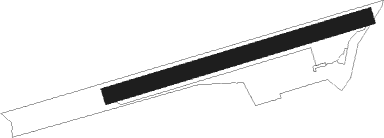
Floudès - La Réole Floudès
Airport details
| Country | France |
| State | Nouvelle-Aquitaine |
| Region | LF |
| Airspace | Bordeaux Ctr |
| Municipality | Floudès |
| Elevation | 43ft (13m) |
| Timezone | GMT +1 |
| Coordinates | 44.56694, -0.05722 |
| Magnetic var | |
| Type | land |
| Available since | X-Plane v10.40 |
| ICAO code | LFDR |
| IATA code | n/a |
| FAA code | n/a |
Communication
| La Réole Floudès CTAF | 123.350 |
Nearby Points of Interest:
Prieuré de La Réole
-Presbytère de Pondaurat
-Domaine de Montalban
-Moulin de Bagas
-Reposoir de Noaillac
-Domaine de Bellecroix
-Enceinte de Saint-Macaire
-Maison à baies géminées trilobées
-Maisons à arcades, place du Mercadiou
-Maison de Gassies
-Cloître de Saint-Macaire
-Maison, rue Carnot à Saint-Macaire
-Madonna mit Kind
-Chemin de croix de Lagupie
-Église Notre-Dame (Sauveterre-de-Guyenne)
-Halle de Monségur
-Portes de Sauveterre-de-Guyenne
-Château de Marcellus
-Maison, 51 rue Maubec
-Allées de Verdelais
-Pigeonnier du Salin
-Église des Bénédictins de Saint-Ferme
-Château Faugas
-chapelle Saint-Benoît de Marmande
-Hospice de Bazas
Nearby beacons
| code | identifier | dist | bearing | frequency |
|---|---|---|---|---|
| SAU | SAUVETERRE DE GUYENNE VOR | 7.7 | 319° | 116.80 |
| BE | BORDEAUX NDB | 23.3 | 312° | 318 |
| BD | BORDEAUX NDB | 30.8 | 306° | 393 |
| BMC | BORDEAUX MERIGNAC VOR/DME | 32.3 | 291° | 113.75 |
| BGC | BERGERAC NDB | 32.6 | 70° | 374 |
| AG | AGEN NDB | 40.1 | 120° | 400 |
| NB | BORDEAUX NDB | 40.6 | 320° | 361 |
| LGH | MARSAN (MONT-DE-MARSAN) VOR/DME | 43.6 | 214° | 111.65 |
| MDM | MARSAN (MONT-DE-MARSAN) TACAN | 43.8 | 214° | 108.70 |
| PX | PERIGUEUX NDB | 54.7 | 58° | 389 |
| AGN | AGEN VOR/DME | 57.1 | 126° | 114.80 |
| LMT | AUCH NDB | 58.4 | 142° | 420 |
| DX | DAX SEYRESSE NDB | 66.9 | 228° | 334 |
Disclaimer
The information on this website is not for real aviation. Use this data with the X-Plane flight simulator only! Data taken with kind consent from X-Plane 12 source code and data files. Content is subject to change without notice.