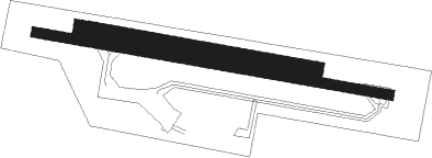
Domme - Sarlat Domme
Airport details
| Country | France |
| State | Nouvelle-Aquitaine |
| Region | LF |
| Airspace | Bordeaux Ctr |
| Municipality | Domme |
| Elevation | 978ft (298m) |
| Timezone | GMT +1 |
| Coordinates | 44.79222, 1.24361 |
| Magnetic var | |
| Type | land |
| Available since | X-Plane v10.40 |
| ICAO code | LFDS |
| IATA code | n/a |
| FAA code | n/a |
Communication
| Sarlat Domme A/A | 118.150 |
Nearby Points of Interest:
Chapelle monolithe de Caudon
-Pech de l’Azé
-Tour-pigeonnier de Labio
-Abbaye Nouvelle (Léobard, France)
-Lanterne des morts de Sarlat-la-Canéda
-Hôtel de Vienne
-Couvent Notre-Dame, Sarlat-la-Canéda
-Monastère des Récollets
-Manoir de Gisson
-Chapelle Notre-Dame-de-l'Olm
-Maison Cavaignac
-Chartreuse du Breuil
-Manor d'Eyrignac
-market hall of Belvès
-Doyenné des Arques
-Château de la Treyne
-roc de Marsal
-Église Notre-Dame-de-l'Assomption de Montgesty
-maison Carlier
-Abri Reverdit
-abri du Facteur
-maison forte de Labastide-Floyras
-maison aux pigeonniers
-Donjon de Jayac
-Gisement préhistorique du Martinet

Nearby beacons
| code | identifier | dist | bearing | frequency |
|---|---|---|---|---|
| BSC | SOUILLAC (BRIVE) NDB | 20.1 | 62° | 351 |
| FC | FIGEAC LIVERNON NDB | 24.2 | 103° | 395 |
| CL | CAHORS NDB | 25.5 | 157° | 348 |
| PX | PERIGUEUX NDB | 26.5 | 319° | 389 |
| BGC | BERGERAC NDB | 26.6 | 272° | 374 |
| AG | AGEN NDB | 45.6 | 222° | 400 |
| TLB | TOULOUSE NDB | 51.5 | 167° | 368 |
| GAI | GAILLAC VOR | 56.1 | 145° | 115.80 |
| AGN | AGEN VOR/DME | 56.5 | 202° | 114.80 |
| LSU | LIMOGES NDB | 59.7 | 352° | 320 |
| AB | ALBI NDB | 63.5 | 137° | 323 |
| AGO | ANGOULEME NDB | 65 | 318° | 404 |
| BE | BORDEAUX NDB | 70 | 273° | 318 |
Disclaimer
The information on this website is not for real aviation. Use this data with the X-Plane flight simulator only! Data taken with kind consent from X-Plane 12 source code and data files. Content is subject to change without notice.