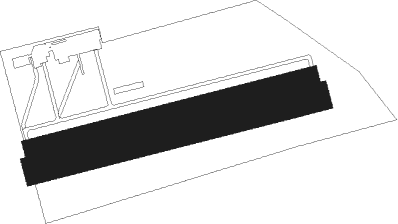
Tarbes - Tarbes Laloubere
Airport details
| Country | France |
| State | Occitania |
| Region | LF |
| Airspace | Bordeaux Ctr |
| Municipality | Laloubère |
| Elevation | 1076ft (328m) |
| Timezone | GMT +1 |
| Coordinates | 43.21686, 0.07365 |
| Magnetic var | |
| Type | land |
| Available since | X-Plane v10.40 |
| ICAO code | LFDT |
| IATA code | n/a |
| FAA code | n/a |
Communication
| Tarbes Laloubere INFO | 122.600 |
Nearby Points of Interest:
Haras national de Tarbes
-Prefecture hotel of Hautes-Pyrénées
-château de Tostat
-Église Saint-Martin d'Orignac
-Chemin de croix des Espélugues
-Bagnères-de-Bigorre war memorial
-Halle et Fontaine de Campan
-Église des Carmes de Trie-sur-Baïse
-Maison carrée de Nay
-Eglise Saint-Jacques-le-Majeur de Tillac
-Gare de Sarrancolin
-Musée Bernadotte
-église Notre-Dame-de-l'Assomption d'Ilhet
-Chapelle Saint-Clamens de Belloc-Saint-Clamens
-église Saint-Martin d'Aspin-Aure
-église Saint-Saturnin de Fréchet-Aure
-Abbaye de Berdoues
-église Saint-Martin de Barrancoueu
-Chapelle Saint-Jean-des-Vignes de Saint-Plancard
-Gare d'Arreau - Cadéac
-église Saint-Étienne de Pailhac
-église Saint-Pierre-aux-Liens d'Ardengost
-hôtel Pouts
-Rohan Tower, Mirande
-église Saint-Félix (Cadéac)
Nearby beacons
| code | identifier | dist | bearing | frequency |
|---|---|---|---|---|
| TL | TARBES NDB | 4.4 | 341° | 321 |
| TBO | TARBES VOR/DME | 7.6 | 32° | 113.90 |
| PO | PAU/PYRENEES NDB | 12 | 292° | 397 |
| LMB | LEMBEYE VOR | 15.5 | 340° | 111.80 |
| PU | PAU/PYRENEES NDB | 17.6 | 285° | 364 |
| LMT | AUCH NDB | 37.8 | 47° | 420 |
| TW | TOULOUSE NDB | 45.6 | 72° | 406 |
| LGH | MARSAN (MONT-DE-MARSAN) VOR/DME | 48.4 | 321° | 111.65 |
| MDM | MARSAN (MONT-DE-MARSAN) TACAN | 48.6 | 320° | 108.70 |
| AGN | AGEN VOR/DME | 53.2 | 50° | 114.80 |
| DX | DAX SEYRESSE NDB | 56 | 294° | 334 |
| AG | AGEN NDB | 61.8 | 33° | 400 |
Disclaimer
The information on this website is not for real aviation. Use this data with the X-Plane flight simulator only! Data taken with kind consent from X-Plane 12 source code and data files. Content is subject to change without notice.

