Amboise - Amboise Dierre
Airport details
| Country | France |
| State | Centre-Val de Loire |
| Region | LF |
| Airspace | Paris Ctr |
| Municipality | Dierre |
| Elevation | 175ft (53m) |
| Timezone | GMT +1 |
| Coordinates | 47.34056, 0.94111 |
| Magnetic var | |
| Type | land |
| Available since | X-Plane v10.32 |
| ICAO code | LFEF |
| IATA code | n/a |
| FAA code | n/a |
Communication
| Amboise Dierre Amboise Info | 118.775 |
| Amboise Dierre Seine Info | 134.875 |
Nearby Points of Interest:
Ferme de Cours
-Château d'Azay-sur-Cher
-Fanum des Châteliers
-Greniers de César
-Rempart gaulois des Châteliers
-Lanterne des Morts de Cormery
-Abbaye de Cormery
-Château de Valmer
-Château de La Vallière
-hôtel-Dieu de Montbazon
-Maison Putsinus
-Couvent des Ursulines de Tours
-Maladrerie Saint-Lazare (Tours)
-Hôtel du Doyenné de Saint-Gatien
-hôtel de Chanoines
-Ancienne maison canoniale, 1 place Grégoire-de-Tours
-Enceinte gallo-romaine de Tours
-maison canoniale du Curé de Tours
-Ancienne maison canoniale de Saint-Gatien
-Hôtel Liebert de Nitray
-hôtel, 43 rue Émile-Zola, 60 rue de la Préfecture
-hôtel, 7 rue de la Barre
-Hôtel de Ville de Tours
-hôtel, 33bis rue du Cygne
-Pont suspendu de Saint-Symphorien
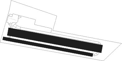
Runway info
Runway 11 / 29  | ||
| length | 701m (2300ft) | |
| bearing | 100° / 280° | |
| width | 25m (82ft) | |
| surface | asphalt | |
| displ threshold | 133m (436ft) / 74m (243ft) | |
| Runway 11L / 29R | ||
| length | 698m (2290ft) | |
| bearing | 100° / 280° | |
| width | 60m (197ft) | |
| surface | grass | |
| displ threshold | 80m (262ft) / 60m (197ft) | |
Nearby beacons
| code | identifier | dist | bearing | frequency |
|---|---|---|---|---|
| AMB | AMBOISE NDB | 6.1 | 52° | 341 |
| AMB | AMBOISE VOR/DME | 7.3 | 54° | 113.70 |
| TUR | TOURS VAL DE LOIRE TACAN | 9.8 | 291° | 113.80 |
| TUR | TOURS VAL DE LOIRE NDB | 14.9 | 325° | 331 |
| BLB | BLOIS NDB | 22.6 | 38° | 397 |
| CTX | CHATEAUROUX DEOLS NDB | 42.6 | 115° | 428 |
| PI | POITIERS NDB | 44 | 220° | 363 |
| LM | LE MANS NDB | 45.5 | 306° | 326 |
| CHN | CHATEAUDUN TACAN | 46.4 | 31° | 110.20 |
| AS | ANGERS NDB | 46.5 | 282° | 392 |
| CAD | CHATEAUDUN VOR/DME | 46.7 | 32° | 115.95 |
| BCY | ORLEANS VOR/DME | 50.8 | 52° | 117.35 |
| OAN | ORLEANS-BRICY NDB | 51.9 | 51° | 385 |
| POI | POITIERS BIARDS VOR | 52.6 | 220° | 113.30 |
| LP | CHOLET NDB | 73.6 | 263° | 357 |
| ANG | ANGERS VOR | 73.7 | 276° | 113 |
Disclaimer
The information on this website is not for real aviation. Use this data with the X-Plane flight simulator only! Data taken with kind consent from X-Plane 12 source code and data files. Content is subject to change without notice.