Vimory - Montargis Vimory
Airport details
| Country | France |
| State | Centre-Val de Loire |
| Region | LF |
| Airspace | Paris Ctr |
| Municipality | Vimory |
| Elevation | 308ft (94m) |
| Timezone | GMT +1 |
| Coordinates | 47.96056, 2.68583 |
| Magnetic var | |
| Type | land |
| Available since | X-Plane v10.40 |
| ICAO code | LFEM |
| IATA code | n/a |
| FAA code | n/a |
Communication
| Montargis Vimory CTAF | 123.350 |
| Montargis Vimory Dep | 123.350 |
Nearby Points of Interest:
Moulin Bardin d'Amilly
-Ferrières Abbey
-Rigole de Courpalet
-Pont du Gril de Corbelin
-Abbaye de Cercanceaux
-Halle de Beaumont-du-Gâtinais
-Ancien château de Beaumont du Gâtinais
-polissoirs de Souppes-sur-Loing
-Croix hosannière de La Madeleine-sur-Loing
-Halles d'Égreville
-Château du Hallier
-chapelle Saint-Hubert de Courcelles
-Musée de préhistoire d'Ile-de-France
-Great Bridge of Nemours
-Croix de la Pierre Percée
-Château de Piffonds
-Château d'Ordon
-Monument à Jean-Félix Bapterosses
-Château de Grandchamp
-bridge of Grez-sur-Loing
-Collegiale Saint Georges de Pithiviers
-Église Saint-Savinien-le-jeune de Sens
-Pierre Plantée de Dormelles
-Mantelot
-Ferrier of Tannerre-en-Puisaye
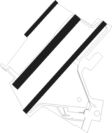
Runway info
Runway 05 / 23  | ||
| length | 1201m (3940ft) | |
| bearing | 57° / 237° | |
| width | 50m (164ft) | |
| surface | grass | |
| displ threshold | 40m (131ft) / 0m (0ft) | |
| Runway 05C / 23C | ||
| length | 901m (2956ft) | |
| bearing | 58° / 238° | |
| width | 80m (262ft) | |
| surface | grass | |
| Runway 05L / 23R | ||
| length | 441m (1447ft) | |
| bearing | 58° / 238° | |
| width | 40m (131ft) | |
| surface | grass | |
| displ threshold | 0m (0ft) / 140m (459ft) | |
Nearby beacons
| code | identifier | dist | bearing | frequency |
|---|---|---|---|---|
| ORS | ORLEANS SAINT DENIS DE L'HOTEL NDB | 17.8 | 267° | 322 |
| PTV | PITHIVIERS VOR | 20.5 | 295° | 116.50 |
| MLN | MELUN VILLAROCHE VOR/DME | 30.1 | 14° | 113.60 |
| AX | AUXERRE NDB | 32.9 | 93° | 417 |
| BRY | BRAY SUR SEINE VOR/DME | 36.2 | 54° | 114.10 |
| OAN | ORLEANS-BRICY NDB | 36.9 | 273° | 385 |
| BCY | ORLEANS VOR/DME | 37.4 | 272° | 117.35 |
| MV | MELUN NDB | 37.5 | 26° | 434 |
| POY | ORLY (PARIS) NDB | 47.7 | 339° | 334 |
| NEV | NEVERS VOR | 49.4 | 163° | 113.40 |
| RBT | RAMBOUILLET VOR/DME | 49.9 | 315° | 114.70 |
| AVD | AVORD NDB | 50.6 | 172° | 288 |
| TSU | TOUSSUS LE NOBLE VOR | 53 | 324° | 108.25 |
| TA | VILLACOUBLAY NDB | 54 | 324° | 286 |
| AVD | AVORD TACAN | 54.2 | 184° | 110.60 |
| CLM | COULOMMIERS VOR/DME | 54.6 | 20° | 112.90 |
| HOL | VILLACOUBLAY NDB | 57.7 | 312° | 315 |
| BRG | BOURGES NDB | 58.9 | 203° | 375 |
Disclaimer
The information on this website is not for real aviation. Use this data with the X-Plane flight simulator only! Data taken with kind consent from X-Plane 12 source code and data files. Content is subject to change without notice.