Quiberon
Airport details
| Country | France |
| State | Brittany |
| Region | LF |
| Airspace | Brest Ctr |
| Municipality | Quiberon |
| Elevation | 38ft (12m) |
| Timezone | GMT +1 |
| Coordinates | 47.48139, -3.10167 |
| Magnetic var | |
| Type | land |
| Available since | X-Plane v10.40 |
| ICAO code | LFEQ |
| IATA code | n/a |
| FAA code | n/a |
Communication
| Quiberon NANTES INFO | 122.800 |
| Quiberon QUIBERON Departure | 119.600 |
Nearby Points of Interest:
Côte Sauvage (Presqu'île de Quiberon)
-calvaire Saint-Michel de Carnac
-Carnac stones
-cromlech sud de Kerlescan
-Cromlech nord de Kerlescan
-Dolmen de Kermané
-Citadelle Vauban du Palais
-menhir du Bronso
-Croix de cimetière de Locmariaquer
-Mané-Brisil dolmen
-Dolmens de Roh-Vras
-sépulture circulaire dite de Toul-Prieu
-Ramparts of Le Palais
-cromlech de Crucuno
-Manoir de Crawford
-Ossuaire de Crach
-Aiguade Vauban
-Abbaye Saint-Gildas Saint-Gildas-de-Rhuys
-Dune de Donnant
-Etel lifeboat station
-Glacière d'Étel
-Château d'Auray
-oppidum de Mané-Coh-Castel
-Kervilio tide mill
-Dolmen à galerie avec la base de son tumulus
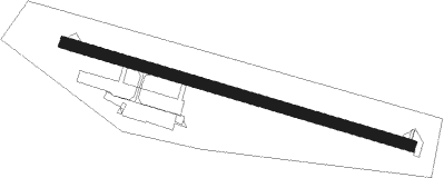
Runway info
| Runway 11 / 29 | ||
| length | 776m (2546ft) | |
| bearing | 105° / 285° | |
| width | 25m (82ft) | |
| surface | asphalt | |
| displ threshold | 101m (331ft) / 80m (262ft) | |
Nearby beacons
| code | identifier | dist | bearing | frequency |
|---|---|---|---|---|
| LOR | LORIENT LANN BIHOUE NDB | 21.7 | 310° | 359 |
| VA | VANNES NDB | 24.8 | 57° | 342 |
| PNT | PONTIVY NDB | 36.3 | 28° | 377 |
| RQ | QUIMPER NDB | 46.5 | 298° | 380 |
| ARE | MONTS D'ARREE VOR | 54.9 | 330° | 112.50 |
Disclaimer
The information on this website is not for real aviation. Use this data with the X-Plane flight simulator only! Data taken with kind consent from X-Plane 12 source code and data files. Content is subject to change without notice.