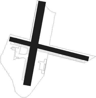
Til-châtel
Airport details
| Country | France |
| State | Bourgogne-Franche-Comté |
| Region | LF |
| Airspace | Reims Ctr |
| Municipality | Véronnes |
| Elevation | 937ft (286m) |
| Timezone | GMT +1 |
| Coordinates | 47.54639, 5.21083 |
| Magnetic var | |
| Type | land |
| Available since | X-Plane v10.40 |
| ICAO code | LFET |
| IATA code | n/a |
| FAA code | n/a |
Communication
| Til-Châtel CTAF | 123.500 |
Nearby Points of Interest:
Bèze Abbey
-Château de Champlitte
-Couvent des Augustins de Champlitte
-Croix de cimetière de Verseilles-le-Haut
-Fontaine-lavoir sud
-Villa Pernot
-Hôtel de Saulx
-Hôtel de Noident
-hôtel de Pourlans
-Hôtel Coeurderoy
-Place Dupuis
-cellier de Morimont
-Ancien couvent de la Visitation
-Hôtel Pouffier
-Hôtel du Commandant militaire
-Cellier de Clairvaux (Dijon)
-Hôtel Bouhier de Lantenay
-place Saint-Bernard
-Hôtel de Saint-Seine
-Hôtel des Griffons
-Hôtel Arviset Jehannin de Chamblanc (Dijon)
-Hôtel de Laloge
-Halles de Dijon
-Hôtel Rolin
-Hôtel de la Croix-de-Fer
Nearby beacons
| code | identifier | dist | bearing | frequency |
|---|---|---|---|---|
| DJL | DIJON LONGVIC VOR/DME | 17.1 | 202° | 111.45 |
| RLP | ROLAMPONT VOR/DME | 21.6 | 6° | 117.30 |
| DO | DOLE NDB | 34.2 | 171° | 309 |
| BSV | BESANCON NDB | 43.6 | 106° | 370 |
| CC | CHAMPFORGEUIL NDB | 51.7 | 204° | 391 |
| EPL | EPINAL MIRECOURT VOR | 57.5 | 48° | 113 |
| EMT | EPINAL NDB | 61.5 | 51° | 419 |
Disclaimer
The information on this website is not for real aviation. Use this data with the X-Plane flight simulator only! Data taken with kind consent from X-Plane 12 source code and data files. Content is subject to change without notice.

