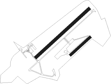
Saint-andré-de-l'eure - Saint Andre De L'eure
Airport details
| Country | France |
| State | Normandy |
| Region | LF |
| Airspace | Paris Ctr |
| Municipality | Saint-André-de-l'Eure |
| Elevation | 498ft (152m) |
| Timezone | GMT +1 |
| Coordinates | 48.89750, 1.25083 |
| Magnetic var | |
| Type | land |
| Available since | X-Plane v10.40 |
| ICAO code | LFFD |
| IATA code | n/a |
| FAA code | n/a |
Communication
Nearby Points of Interest:
Alignement des Bruyères
-Pavillon de chasse de la forêt de Dreux
-Dolmen de l'Hôtel-Dieu
-Forêt d'Évreux
-Abbaye Notre-Dame d'Ivry-la-Bataille
-Rempart gallo-romain d'Évreux
-Théâtre Municipal d'Évreux
-Église Saint-Taurin d'Évreux
-Petit Château de Navarre
-Église Notre-Dame de Cocherel
-castle of Dreux
-belfry of Dreux
-Château de Tillières-sur-Avre
-Château de La Croix-Saint-Leufroy
-Abbaye Saint-Pierre-et-Saint-Paul de Châtillon-lès-Conches
-Château des Rotoirs
-Town hall of Vernon, Eure
-maison du Temps Jadis
-immeuble Benac
-Croix de cimetière
-Hôtel du Lys
-Manoir de Pommereuil
-Pont des Planches
-Maison à tourelle, 620 rue de la Madeleine, Verneuil-sur-Avre
-Manoir du Clos-de-l'Aître

Nearby beacons
| code | identifier | dist | bearing | frequency |
|---|---|---|---|---|
| EVX | EVREUX FAUVILLE VORTAC | 8.1 | 347° | 112.40 |
| EPR | EPERNON VOR/DME | 22.9 | 124° | 115.65 |
| HOL | VILLACOUBLAY NDB | 24.6 | 106° | 315 |
| CHW | CHARTRES VOR/DME | 27.1 | 212° | 115.20 |
| LGL | L'AIGLE VOR/DME | 29.1 | 262° | 112.70 |
| RBT | RAMBOUILLET VOR/DME | 32.8 | 108° | 114.70 |
| PON | PONTOISE CORMEILLES EN VE VOR | 33.1 | 76° | 111.60 |
| ROU | ROUEN VALLEE DE SEINE VOR | 34.1 | 3° | 116.80 |
| TA | VILLACOUBLAY NDB | 34.3 | 98° | 286 |
| TSU | TOUSSUS LE NOBLE VOR | 34.7 | 100° | 108.25 |
| DVL | DEAUVILLE NORMANDIE VOR | 44.4 | 294° | 110.20 |
| BV | BEAUVAIS NDB | 46.9 | 53° | 391 |
| BOV | BEAUVAIS TILLE VOR/DME | 47.9 | 59° | 109.65 |
| CAD | CHATEAUDUN VOR/DME | 50.6 | 171° | 115.95 |
| CHN | CHATEAUDUN TACAN | 50.7 | 172° | 110.20 |
| OAN | ORLEANS-BRICY NDB | 57.6 | 150° | 385 |
| BCY | ORLEANS VOR/DME | 58.3 | 151° | 117.35 |
| DSA | DIEPPE NDB | 59.4 | 350° | 351 |
| CNE | CAEN NDB | 63.3 | 278° | 404 |
| CAN | CAEN CARPIQUET VOR/DME | 69.1 | 279° | 114.45 |
| ORS | ORLEANS SAINT DENIS DE L'HOTEL NDB | 69.9 | 134° | 322 |
Disclaimer
The information on this website is not for real aviation. Use this data with the X-Plane flight simulator only! Data taken with kind consent from X-Plane 12 source code and data files. Content is subject to change without notice.