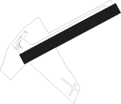
Guiscriff - Enghien Moisselles
Airport details
| Country | France |
| State | Ile-de-France |
| Region | LF |
| Airspace | Paris Ctr |
| Municipality | Attainville |
| Elevation | 333ft (101m) |
| Timezone | GMT +1 |
| Coordinates | 49.04556, 2.35194 |
| Magnetic var | |
| Type | land |
| Available since | X-Plane v10.40 |
| ICAO code | LFFE |
| IATA code | n/a |
| FAA code | n/a |
Communication
| Enghien Moisselles CTAF | 121.250 |
Nearby Points of Interest:
Colombier d'Andilly
-Hôtel de Mézières
-Pigeonnier de la ferme de Montmorency
-Colombier d'Orgemont
-Colombier de Garlande
-Town hall of Stains
-Paris–Le Bourget Airport
-Town hall of Épinay-sur-Seine
-colombier-porche
-Tour Saint-Rieul, Louvres
-Palais abbatial de Royaumont
-Hôtel du Croissant
-église des Trois-Patrons
-Pont de l'île Saint-Denis
-Couvent des Ursulines, Saint-Denis
-Ancienne gare de Gennevilliers
-Parc des Chanteraines
-Baptismal font of Notre-Dame (Champagne-sur-Oise)
-Calvaire de Champagne-sur-Oise
-Fort de Cormeilles-en-Parisis
-Thermal power plant of Gennevilliers
-Maison-atelier de Charles-François Daubigny
-Chapelle Sainte-Jeanne-d'Arc de Gennevilliers
-Pont de Saint-Ouen-les-Docks
-Dépôt de La Plaine
Nearby beacons
| code | identifier | dist | bearing | frequency |
|---|---|---|---|---|
| BT | LE BOURGET (PARIS) VOR/DME | 5.8 | 124° | 116.10 |
| CGN | (PARIS) DME | 6 | 100° | 115.35 |
| PGS | CHARLES-DE-GAULLE (PARIS) VOR/DME | 11 | 100° | 117.05 |
| PON | PONTOISE CORMEILLES EN VE VOR | 12.8 | 279° | 111.60 |
| POY | ORLY (PARIS) NDB | 19 | 173° | 334 |
| TA | VILLACOUBLAY NDB | 19.2 | 223° | 286 |
| TSU | TOUSSUS LE NOBLE VOR | 20.1 | 221° | 108.25 |
| BOV | BEAUVAIS TILLE VOR/DME | 24.7 | 333° | 109.65 |
| RBT | RAMBOUILLET VOR/DME | 27.4 | 222° | 114.70 |
| HOL | VILLACOUBLAY NDB | 28.2 | 239° | 315 |
| CLM | COULOMMIERS VOR/DME | 28.7 | 107° | 112.90 |
| BSN | DME | 28.9 | 79° | 114.85 |
| BV | BEAUVAIS NDB | 29.6 | 324° | 391 |
| MTD | MONTDIDIER VOR | 30.9 | 15° | 113.65 |
| EPR | EPERNON VOR/DME | 37.3 | 239° | 115.65 |
| MV | MELUN NDB | 38.5 | 128° | 434 |
| MLN | MELUN VILLAROCHE VOR/DME | 39.8 | 142° | 113.60 |
| GI | AMIENS NDB | 48.1 | 9° | 339 |
| BRY | BRAY SUR SEINE VOR/DME | 53.5 | 124° | 114.10 |
| PTV | PITHIVIERS VOR | 53.5 | 186° | 116.50 |
| ABY | ALBERT BRAY NDB | 58.6 | 26° | 321 |
| CAD | CHATEAUDUN VOR/DME | 70.5 | 224° | 115.95 |
| CHN | CHATEAUDUN TACAN | 70.9 | 225° | 110.20 |
Disclaimer
The information on this website is not for real aviation. Use this data with the X-Plane flight simulator only! Data taken with kind consent from X-Plane 12 source code and data files. Content is subject to change without notice.
