Chateau-thierry - Chateau Thierry Belleau
Airport details
| Country | France |
| State | Hauts-de-France |
| Region | LF |
| Airspace | Paris Ctr |
| Municipality | Château-Thierry |
| Elevation | 728ft (222m) |
| Timezone | GMT +1 |
| Coordinates | 49.06431, 3.35033 |
| Magnetic var | |
| Type | land |
| Available since | X-Plane v10.40 |
| ICAO code | LFFH |
| IATA code | n/a |
| FAA code | n/a |
Communication
Nearby Points of Interest:
Ancien couvent des Cordeliers de Château-Thierry
-Tour Balhan
-Remparts de Château-Thierry
-Halles (Marigny-en-Orxois)
-Rocher gravé (Brécy)
-Croix de cimetière de Mézy-Moulins
-Polissoir de Neuilly-Saint-Front
-Mézy-Moulins polissoir
-Ponts Bernard
-Croix de cimetière de Connigis
-Église Saint-Denis
-Maison natale de Paul Claudel
-Prieuré d'Oulchy-le-Château
-Halles de Condé-en-Brie
-Château de Saponay
-Halles de Fère-en-Tardenois
-Église Saint-Médard d'Ancienville
-Croix monumentale d'Ancienville
-Carauda dolmen
-Crypte Saint-Paul
-Croix de Jouarre
-Ferme de Villefontaine
-Hôtellerie du Régent
-Fontaine de la coquille
-Hôtel de ville de Villers-Cotterêts
Runway info
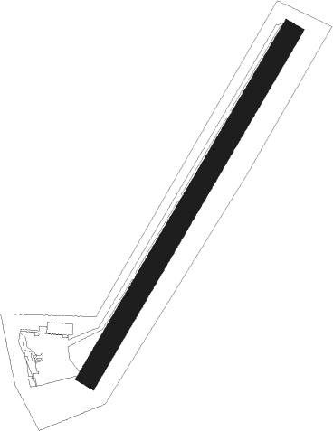
| Runway 04 / 22 | ||
| length | 931m (3054ft) | |
| bearing | 47° / 227° | |
| width | 50m (164ft) | |
| surface | grass | |
| displ threshold | 160m (525ft) / 150m (492ft) | |
Nearby beacons
| code | identifier | dist | bearing | frequency |
|---|---|---|---|---|
| CTL | CHATILLON SUR MARNE VOR/DME | 9.9 | 72° | 117.60 |
| BSN | DME | 13.7 | 293° | 114.85 |
| CLM | COULOMMIERS VOR/DME | 18.7 | 237° | 112.90 |
| PGS | CHARLES-DE-GAULLE (PARIS) VOR/DME | 28.8 | 265° | 117.05 |
| VAT | CHALONS NDB | 30.7 | 112° | 367 |
| REM | REIMS VOR | 31 | 70° | 112.30 |
| CGN | (PARIS) DME | 33.5 | 267° | 115.35 |
| MV | MELUN NDB | 34 | 216° | 434 |
| BT | LE BOURGET (PARIS) VOR/DME | 35.6 | 264° | 116.10 |
| CAV | CHALONS VOR/DME | 35.7 | 110° | 111.65 |
| BRY | BRAY SUR SEINE VOR/DME | 39.5 | 185° | 114.10 |
| MLN | MELUN VILLAROCHE VOR/DME | 42.2 | 221° | 113.60 |
| CVT | CHALONS NDB | 42.3 | 107° | 347 |
| POY | ORLY (PARIS) NDB | 42.9 | 251° | 334 |
| MTD | MONTDIDIER VOR | 44.6 | 300° | 113.65 |
| TY | TROYES NDB | 47.5 | 135° | 320 |
| TRO | TROYES BARBEREY VOR | 54.5 | 143° | 116 |
| GI | AMIENS NDB | 57.6 | 312° | 339 |
| ABY | ALBERT BRAY NDB | 58.6 | 329° | 321 |
Disclaimer
The information on this website is not for real aviation. Use this data with the X-Plane flight simulator only! Data taken with kind consent from X-Plane 12 source code and data files. Content is subject to change without notice.