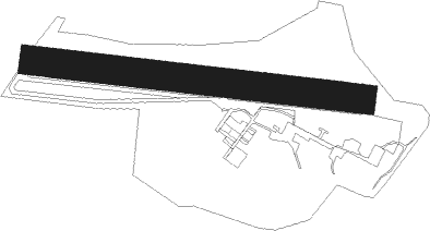
La Ferté-alais - La Ferte Alais
Airport details
| Country | France |
| State | Ile-de-France |
| Region | LF |
| Airspace | Paris Ctr |
| Municipality | Cerny |
| Elevation | 454ft (138m) |
| Timezone | GMT +1 |
| Coordinates | 48.49691, 2.34210 |
| Magnetic var | |
| Type | land |
| Available since | X-Plane v10.40 |
| ICAO code | LFFQ |
| IATA code | n/a |
| FAA code | n/a |
Communication
| La Ferte Alais ATC Freq | 129.750 |
Nearby Points of Interest:
Château du Saussay
-Croix Boissée
-Château de Farcheville
-Roche Grénolée
-polissoir de la Petite-Garenne
-polissoir du bois de la Briche
-Prieuré d'Étampes
-bornes fleurdelysées
-polissoir du bois de la Guigneraie
-polissoir du bois de la Charmille
-Hôtel Dieu
-Moulin de Choiseau
-Usine Leroy (Saint-Fargeau-Ponthierry)
-Vestiges des anciens remparts
-Autodrome de Linas-Montlhéry
-polissoir du Goulet
-Marché couvert
-Grands moulins de Corbeil
-Forêt de Rougeau
-Sépulture d'Isabelle et René Viviani
-Menhir de la Pierre-aux-Prêtres
-polissoir de la Pierre-aux-Prêtres
-La Grande Borne
-Wurzel-Jesse-Fenster
-Pigeonnier de Boissise-le-Roi
Nearby beacons
| code | identifier | dist | bearing | frequency |
|---|---|---|---|---|
| POY | ORLY (PARIS) NDB | 14.1 | 12° | 334 |
| RBT | RAMBOUILLET VOR/DME | 16.7 | 294° | 114.70 |
| TSU | TOUSSUS LE NOBLE VOR | 18.1 | 317° | 108.25 |
| MLN | MELUN VILLAROCHE VOR/DME | 18.9 | 95° | 113.60 |
| TA | VILLACOUBLAY NDB | 19.1 | 318° | 286 |
| PTV | PITHIVIERS VOR | 20.7 | 193° | 116.50 |
| HOL | VILLACOUBLAY NDB | 25 | 294° | 315 |
| MV | MELUN NDB | 25.5 | 85° | 434 |
| EPR | EPERNON VOR/DME | 28.3 | 281° | 115.65 |
| BT | LE BOURGET (PARIS) VOR/DME | 29 | 13° | 116.10 |
| CGN | (PARIS) DME | 32 | 17° | 115.35 |
| PGS | CHARLES-DE-GAULLE (PARIS) VOR/DME | 32.1 | 29° | 117.05 |
| CLM | COULOMMIERS VOR/DME | 33.8 | 63° | 112.90 |
| ORS | ORLEANS SAINT DENIS DE L'HOTEL NDB | 33.8 | 190° | 322 |
| OAN | ORLEANS-BRICY NDB | 37.5 | 229° | 385 |
| PON | PONTOISE CORMEILLES EN VE VOR | 37.9 | 333° | 111.60 |
| BRY | BRAY SUR SEINE VOR/DME | 38.3 | 95° | 114.10 |
| BCY | ORLEANS VOR/DME | 38.6 | 229° | 117.35 |
| CAD | CHATEAUDUN VOR/DME | 46.3 | 245° | 115.95 |
| CHN | CHATEAUDUN TACAN | 46.8 | 245° | 110.20 |
| BSN | DME | 50.2 | 46° | 114.85 |
| BOV | BEAUVAIS TILLE VOR/DME | 56.9 | 349° | 109.65 |
| BV | BEAUVAIS NDB | 61 | 343° | 391 |
Disclaimer
The information on this website is not for real aviation. Use this data with the X-Plane flight simulator only! Data taken with kind consent from X-Plane 12 source code and data files. Content is subject to change without notice.