Colmar/houssen - Houssen
Airport details
| Country | France |
| State | Grand Est |
| Region | LF |
| Airspace | Reims Ctr |
| Municipality | Colmar |
| Elevation | 625ft (190m) |
| Timezone | GMT +1 |
| Coordinates | 48.11035, 7.35915 |
| Magnetic var | |
| Type | land |
| Available since | X-Plane v10.40 |
| ICAO code | LFGA |
| IATA code | CMR |
| FAA code | n/a |
Communication
| Houssen LFGA ATIS | 121.875 |
| Houssen HOUSSEN Tower | 119.000 |
| Houssen COLMAR Approach | 118.950 |
| Houssen BASLE Approach | 119.350 |
Nearby Points of Interest:
Calvary of cimetière de Colmar
-Hôtel de ville de Colmar
-Hôtel de Reiset
-Immeuble, 4 rue des Artisans (Colmar)
-Couvent des Catherinettes
-Well on place des Dominicains
-Madonna of the Rose Garden
-Poêle des Laboureurs
-Immeuble au 7, place de la Cathédrale à Colmar
-Grenier à grains médiéval
-Maison Wildungshof
-Maison zum Kragen
-Maison natale d'Auguste Bartholdi
-Maison Schongauer
-Maison, 15 rue Berthe-Molly
-Maison Sandherr
-Maisonnette Bohn
-Ancien hôpital de Colmar
-Maison au 48, rue des Marchands à Colmar
-Maison, 8 rue des Augustins, rue Schongauer (Colmar)
-Immeuble au 23, rue Berthe Molly à Colmar
-Maison zum Oesterreich
-Chancellerie de Colmar
-Ancienne Douane
-Maison Fleischhauer (Colmar)
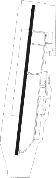
Runway info
| Runway 01 / 19 | ||
| length | 1611m (5285ft) | |
| bearing | 16° / 196° | |
| width | 30m (98ft) | |
| surface | asphalt | |
| displ threshold | 210m (689ft) / 0m (0ft) | |
| blast zone | 0m (0ft) / 10m (33ft) | |
Nearby beacons
| code | identifier | dist | bearing | frequency |
|---|---|---|---|---|
| HO | COLMAR-HOUSSEN NDB | 1.4 | 17° | 380 |
| LHR | LAHR NDB | 23 | 62° | 337 |
| LRD | DME | 24.1 | 62° | 108.05 |
| STR | STRASBOURG ENTZHEIM VOR/DME | 25.2 | 28° | 115.60 |
| BN | BASLE-MULHOUSE NDB | 27.3 | 165° | 353 |
| BLM | BASLE-MULHOUSE VOR/DME | 29.2 | 164° | 117.45 |
| SE | STRASBOURG NDB | 32 | 37° | 412 |
| BS | BASLE-MULHOUSE NDB | 32.6 | 162° | 376 |
| PHG | PHALSBOURG NDB | 39.9 | 346° | 424 |
| MB | MONTBELIARD NDB | 40.4 | 216° | 330 |
| HOC | DME | 40.5 | 155° | 113.20 |
| SAV | SAVERNE VOR/DME | 41.3 | 7° | 110.45 |
| HR | HERICOURT NDB | 41.5 | 229° | 289 |
| KBD | DME | 49.6 | 47° | 115.80 |
| KBA | KARLSRUHE/BADEN-BADEN NDB | 50.6 | 47° | 431 |
| GRE | GRENCHEN VOR/DME | 55.7 | 176° | 115.45 |
| GTQ | GROSTENQUIN VOR/DME | 58.4 | 324° | 111.25 |
| WIL | WILLISAU VOR/DME | 60.1 | 150° | 116.90 |
Instrument approach procedures
| runway | airway (heading) | route (dist, bearing) |
|---|---|---|
| RW01 | ALTIK (26°) | ALTIK 6500ft GA505 (12mi, 39°) IGA01 (7mi, 16°) FGA01 (4mi, 16°) 2500ft |
| RW01 | HO (197°) | HO 6000ft GA502 (5mi, 97°) 2500ft GA503 (12mi, 196°) 2500ft IGA01 (5mi, 277°) 2500ft FGA01 (4mi, 16°) 2500ft |
| RNAV | FGA01 2500ft LFGA (6mi, 16°) 675ft GA511 (4mi, 16°) GA503 (15mi, 167°) 2500ft IGA01 (5mi, 277°) 3000ft | |
| RW19 | GA405 (229°) | GA405 IGA19 (6mi, 277°) 3300ft |
| RW19 | HO (197°) | HO GA405 (13mi, 52°) IGA19 (6mi, 277°) 3300ft |
| RNAV | IGA19 3300ft FGA19 (4mi, 196°) 3300ft LFGA (9mi, 196°) 660ft GA409 (5mi, 196°) HO (6mi, 16°) 4700ft HO (turn) 4700ft |
Disclaimer
The information on this website is not for real aviation. Use this data with the X-Plane flight simulator only! Data taken with kind consent from X-Plane 12 source code and data files. Content is subject to change without notice.