Colmar - Avallon
Airport details
| Country | France |
| State | Bourgogne-Franche-Comté |
| Region | LF |
| Airspace | Paris Ctr |
| Municipality | Avallon |
| Elevation | 823ft (251m) |
| Timezone | GMT +1 |
| Coordinates | 47.50097, 3.89835 |
| Magnetic var | |
| Type | land |
| Available since | X-Plane v10.32 |
| ICAO code | LFGE |
| IATA code | n/a |
| FAA code | n/a |
Communication
| Avallon CTAF | 123.500 |
Nearby Points of Interest:
Hôtel Condé
-Remparts d'Avallon
-château d'Annéot
-Calvaire de Pontaubert
-Château de Vault-de-Lugny
-Château de Montjalin
-Église de la Nativité-de-Notre-Dame de Vassy
-Maison des Goix
-Lavoir de Voutenay-sur-Cure
-Ancienne église Saint-Pierre de Saint-Père
-Fortifications de Montréal (Yonne)
-Croix de Vézelay
-château abbatial de Vézelay
-Camp antique de Cora
-Enceinte de Vézelay
-Maison natale de Théodore de Bèze
-Château de Cisery
-caves of Arcy-sur-Cure
-Château de Jouancy
-City gate of Noyers-sur-Serein
-Éolienne et lavoir de Vignol
-Town hall of Noyers-sur-Serein
-Maison de la Toison d'Or
-porte de Tonnerre
-Moutier-Saint-Jean de Réôme
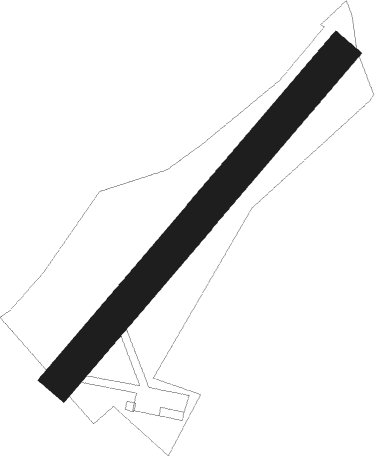
Runway info
| Runway 04 / 22 | ||
| length | 751m (2464ft) | |
| bearing | 56° / 236° | |
| width | 60m (197ft) | |
| surface | grass | |
| displ threshold | 125m (410ft) / 155m (509ft) | |
Nearby beacons
| code | identifier | dist | bearing | frequency |
|---|---|---|---|---|
| AX | AUXERRE NDB | 29.8 | 317° | 417 |
| NV | NEVERS NDB | 43.6 | 232° | 394 |
| NEV | NEVERS VOR | 44.6 | 250° | 113.40 |
| TRO | TROYES BARBEREY VOR | 45.1 | 5° | 116 |
| MOU | MOULINS VOR/DME | 48.9 | 199° | 116.70 |
| TY | TROYES NDB | 54.1 | 7° | 320 |
| AV | AVORD NDB | 54.3 | 237° | 306 |
| BRY | BRAY SUR SEINE VOR/DME | 59.5 | 326° | 114.10 |
| CC | CHAMPFORGEUIL NDB | 60.6 | 130° | 391 |
Disclaimer
The information on this website is not for real aviation. Use this data with the X-Plane flight simulator only! Data taken with kind consent from X-Plane 12 source code and data files. Content is subject to change without notice.