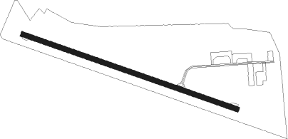
Cosne-sur-loire - Cosne Sur Loire
Airport details
| Country | France |
| State | Bourgogne-Franche-Comté |
| Region | LF |
| Airspace | Paris Ctr |
| Municipality | Cosne-Cours-sur-Loire |
| Elevation | 580ft (177m) |
| Timezone | GMT +1 |
| Coordinates | 47.36125, 2.92216 |
| Magnetic var | |
| Type | land |
| Available since | X-Plane v10.40 |
| ICAO code | LFGH |
| IATA code | n/a |
| FAA code | n/a |
Communication
| Cosne sur Loire INFO | 123.500 |
Nearby Points of Interest:
Couvent des Augustins de Cosne-Cours-sur-Loire
-Prieuré de l'épeau
-Ancienne église Saint-Pierre
-Buildings by ceramist Jean Linard
-Mantelot
-Château de Maupas
-Haut-fourneau de Bourgneuf
-château de Sauvages
-Tour de l'Horloge de Saint-Fargeau
-Monument à Jean-Félix Bapterosses
-Maison forte de Mornay
-Église Sainte-Eugénie de Varzy
-Forges royales de la Chaussade
-Chapelle funéraire de la famille Laborde
-Notre-Dame de Pitié
-Fonderie de Nevers
-Ferrier of Tannerre-en-Puisaye
-Tour Saint-Trohé, Nevers
-Abbaye de Fonmorigny
-Rempart des Carmélites, Nevers
-Hôtel de ville de Nevers
-Petit château La Gloriette
-Chambre des comptes de Nevers
-Église Notre-Dame de Nevers
-Tour Saint-Éloi, Nevers
Nearby beacons
| code | identifier | dist | bearing | frequency |
|---|---|---|---|---|
| NEV | NEVERS VOR | 12.5 | 178° | 113.40 |
| AVD | AVORD NDB | 15.2 | 207° | 288 |
| AVD | AVORD TACAN | 21.7 | 224° | 110.60 |
| NV | NEVERS NDB | 26.7 | 147° | 394 |
| AV | AVORD NDB | 28.8 | 179° | 306 |
| BRG | BOURGES NDB | 33.2 | 242° | 375 |
| AX | AUXERRE NDB | 40.9 | 46° | 417 |
| ORS | ORLEANS SAINT DENIS DE L'HOTEL NDB | 44.1 | 310° | 322 |
| MOU | MOULINS VOR/DME | 48.8 | 133° | 116.70 |
| PTV | PITHIVIERS VOR | 54.5 | 320° | 116.50 |
Disclaimer
The information on this website is not for real aviation. Use this data with the X-Plane flight simulator only! Data taken with kind consent from X-Plane 12 source code and data files. Content is subject to change without notice.