Joigny
Airport details
| Country | France |
| State | Bourgogne-Franche-Comté |
| Region | LF |
| Airspace | Paris Ctr |
| Municipality | Joigny |
| Elevation | 729ft (222m) |
| Timezone | GMT +1 |
| Coordinates | 47.99445, 3.39083 |
| Magnetic var | |
| Type | land |
| Available since | X-Plane v10.40 |
| ICAO code | LFGK |
| IATA code | n/a |
| FAA code | n/a |
Communication
| Joigny A/A | 123.500 |
Nearby Points of Interest:
Porte du Bois
-Maison de l'Ave Maria
-Maison du Pilori
-Maison du Baillage
-saint-jean gate
-Château des Gondy à Joigny
-Palais de justice de Joigny
-maison Puynesge
-Prieuré de Notre-Dame
-Quartier Dubois-Thainville
-Porte d'enceinte de Cézy
-Maison dite L'Arbre de Jessé
-Maison du Chapitre
-Maison à pans de bois de Saint-Julien-du-Sault
-Maison du poteau Cornier de Saint-Julien-du-Sault
-Maison des Fontenottes
-Menhir de Pierre Frite
-Enceinte de Villeneuve-sur-Yonne
-maison des Sept-Têtes
-maison Joseph-Joubert
-Croix de pierre de Villeneuve-sur-Yonne
-Town hall of Villeneuve-sur-Yonne
-Château d'Ordon
-lavoir de Brienon-sur-Armançon
-Château de Saint-Maurice-Thizouaille
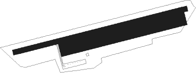
Runway info
Runway 08 / 26  | ||
| length | 1053m (3455ft) | |
| bearing | 83° / 263° | |
| width | 30m (98ft) | |
| surface | asphalt | |
| displ threshold | 74m (243ft) / 225m (738ft) | |
| blast zone | 18m (59ft) / 0m (0ft) | |
| Runway 08R / 26L | ||
| length | 701m (2300ft) | |
| bearing | 83° / 263° | |
| width | 80m (262ft) | |
| surface | grass | |
| displ threshold | 0m (0ft) / 220m (722ft) | |
Nearby beacons
| code | identifier | dist | bearing | frequency |
|---|---|---|---|---|
| AX | AUXERRE NDB | 6.3 | 124° | 417 |
| BRY | BRAY SUR SEINE VOR/DME | 25 | 347° | 114.10 |
| TRO | TROYES BARBEREY VOR | 27.6 | 66° | 116 |
| TY | TROYES NDB | 34.5 | 57° | 320 |
| MLN | MELUN VILLAROCHE VOR/DME | 36 | 309° | 113.60 |
| MV | MELUN NDB | 37.4 | 324° | 434 |
| CLM | COULOMMIERS VOR/DME | 53.2 | 336° | 112.90 |
| NEV | NEVERS VOR | 53.8 | 209° | 113.40 |
| VAT | CHALONS NDB | 54.3 | 38° | 367 |
| CAV | CHALONS VOR/DME | 56 | 44° | 111.65 |
| AVD | AVORD NDB | 57.6 | 214° | 288 |
| CVT | CHALONS NDB | 58.9 | 51° | 347 |
| AVD | AVORD TACAN | 64.1 | 219° | 110.60 |
| BT | LE BOURGET (PARIS) VOR/DME | 69.6 | 316° | 116.10 |
Disclaimer
The information on this website is not for real aviation. Use this data with the X-Plane flight simulator only! Data taken with kind consent from X-Plane 12 source code and data files. Content is subject to change without notice.