Paray Le Monial
Airport details
| Country | France |
| State | Bourgogne-Franche-Comté |
| Region | LF |
| Airspace | Marseille Ctr |
| Municipality | Paray-le-Monial |
| Elevation | 997ft (304m) |
| Timezone | GMT +1 |
| Coordinates | 46.46667, 4.13306 |
| Magnetic var | |
| Type | land |
| Available since | X-Plane v10.40 |
| ICAO code | LFGN |
| IATA code | n/a |
| FAA code | n/a |
Communication
| Paray le Monial INFO | 123.500 |
| Paray le Monial SAINT YAN TOWER | 122.300 |
| Paray le Monial SAINT YAN Approach | 123.400 |
Nearby Points of Interest:
Prieuré Notre-Dame de Paray-le-Monial
-Groupe scolaire Bellevue (Paray-le-Monial)
-Prieuré de Bragny
-Rigole l’Arroux
-Cinq pavillons Fillod
-Prieuré d'Anzy-le-Duc
-Briqueterie des Touillards-Vairet-Baudot
-Couvent des Ursulines de Marcigny
-Hôtel de ville de Marcigny
-Stables of the Château Chaumont-Laguiche
-Maison Cudel de Montcolon
-Maison mitoyenne de la Tour du Moulin
-Prieuré de la Sainte-Trinité de Marcigny-lès-Nonnains
-Hôtel de ville de Semur-en-Brionnais
-Maison du syndicat des mineurs
-Dispensaire de la Croix Rouge
-chapelle Saint-Benoît de Saint-Maurice-lès-Châteauneuf
-War memorial of Montceau-les-Mines
-Édicule de Saint-André-le-Désert
-Remparts de Bourbon-Lancy
-Maison Sévigné
-Porte de ville de Montaiguët-en-Forez
-Doyenné de Bézornay
-Tuilerie de Bissy
-Tuilerie de la Bellevelle
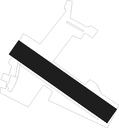
Runway info
| Runway 13 / 31 | ||
| length | 596m (1955ft) | |
| bearing | 120° / 300° | |
| width | 99m (325ft) | |
| surface | grass | |
| displ threshold | 82m (269ft) / 0m (0ft) | |
Nearby beacons
| code | identifier | dist | bearing | frequency |
|---|---|---|---|---|
| SN | SAINT YAN NDB | 10.3 | 184° | 430 |
| RNN | ROANNE NDB | 21.6 | 195° | 358 |
| ROA | ROANNE VOR | 25 | 198° | 110.25 |
| MOU | MOULINS VOR/DME | 25.2 | 296° | 116.70 |
| CC | CHAMPFORGEUIL NDB | 33 | 70° | 391 |
| VZ | VICHY NDB | 36.7 | 245° | 403 |
| TIS | THIERS VOR/DME | 42.5 | 225° | 117.50 |
| NV | NEVERS NDB | 48.6 | 297° | 394 |
| EB | SAINT ETIENNE NDB | 50.1 | 170° | 379 |
| ASM | CLERMONT-FERRAND/AUVERGNE NDB | 51 | 229° | 367 |
| CFA | CLERMONT FERRAND AUVERGNE VOR/DME | 56.5 | 234° | 114.35 |
| BO | SAINT ETIENNE NDB | 57.2 | 170° | 299 |
| LSE | LYON SAINT EXUPERY VOR/DME | 58.8 | 127° | 114.75 |
| BR | LYON-BRON NDB | 62.4 | 135° | 388 |
| DJL | DIJON LONGVIC VOR/DME | 62.4 | 50° | 111.45 |
| VNE | VIENNE REVENTIN VOR | 62.9 | 140° | 108.20 |
Disclaimer
The information on this website is not for real aviation. Use this data with the X-Plane flight simulator only! Data taken with kind consent from X-Plane 12 source code and data files. Content is subject to change without notice.