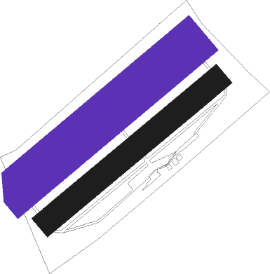
Frauenberg - Sarreguemines Neunkirch
Airport details
| Country | France |
| State | Grand Est |
| Region | LF |
| Airspace | Reims Ctr |
| Municipality | Frauenberg |
| Elevation | 853ft (260m) |
| Timezone | GMT +1 |
| Coordinates | 49.12750, 7.10667 |
| Magnetic var | |
| Type | land |
| Available since | X-Plane v10.40 |
| ICAO code | LFGU |
| IATA code | n/a |
| FAA code | n/a |
Communication
| Sarreguemines Neunkirch ATC Freq | 123.500 |
Nearby Points of Interest:
Casino de la Faïencerie
-St. Lukas
-St. Peter
-Protestantische Kirche (Wolfersheim)
-St. Anna
-Winterbergdenkmal
-Kohlweg 18
-Paul-Marien-Stift
-Garage
-Museum am Schlossplatz
-Gasthaus "Zum Stiefel"
-Gustav-Bruch-Straße 24
-Försterstraße 6/8
-Hôtel de ville d'Oermingen
-Congresshalle
-puits Sainte-Marthe
-St. Maria
-Protestant Church (Hassel, Saar)
-Schlossberg Stadium
-Villa Wagner
-Protestantische Kirche
-Pfarrgaßschulhaus
-Synagoge
-Église Notre-Dame du Wiesberg
-Protestantische Pfarrkirche
Nearby beacons
| code | identifier | dist | bearing | frequency |
|---|---|---|---|---|
| SAD | DME | 5.1 | 6° | 116.75 |
| SR | ENSHEIM (SAARBRUECKEN) NDB | 7 | 51° | 360 |
| ZWN | ZWEIBRUECKEN VOR/DME | 13.6 | 72° | 114.80 |
| GTQ | GROSTENQUIN VOR/DME | 17.5 | 250° | 111.25 |
| PHG | PHALSBOURG NDB | 21.9 | 166° | 424 |
| SAV | SAVERNE VOR/DME | 24 | 134° | 110.45 |
| RMS | RAMSTEIN TACAN | 26.3 | 57° | 113.40 |
| LOU | LORRAINE NDB | 33.7 | 261° | 388 |
| MTZ | METZ NDB | 36.3 | 279° | 354 |
| SE | STRASBOURG NDB | 40.2 | 132° | 412 |
| STR | STRASBOURG ENTZHEIM VOR/DME | 41.6 | 143° | 115.60 |
| KBA | KARLSRUHE/BADEN-BADEN NDB | 43.7 | 108° | 431 |
| KBD | DME | 43.9 | 109° | 115.80 |
| ELU | LUXEMBOURG NDB | 44.3 | 306° | 368 |
| LE | LUXEMBOURG NDB | 45.5 | 301° | 318 |
| LUX | LUXEMBOURG VOR/DME | 45.5 | 301° | 112.25 |
| LW | LUXEMBOURG NDB | 46.6 | 297° | 404 |
| FHH | DME | 49.2 | 11° | 117.35 |
| HAN | HAHN NDB | 50.7 | 12° | 376 |
| SPA | SPANGDAHLEM TACAN | 53.5 | 334° | 109.50 |
| LRD | DME | 54 | 137° | 108.05 |
| LHR | LAHR NDB | 54.4 | 138° | 337 |
| DIK | DIEKIRCH NDB | 58.2 | 307° | 307 |
| EMT | EPINAL NDB | 59.9 | 229° | 419 |
| HO | COLMAR-HOUSSEN NDB | 60.5 | 165° | 380 |
Disclaimer
The information on this website is not for real aviation. Use this data with the X-Plane flight simulator only! Data taken with kind consent from X-Plane 12 source code and data files. Content is subject to change without notice.

