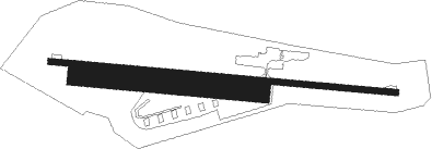
Verdun - Verdun Sommedieue
Airport details
| Country | France |
| State | Grand Est |
| Region | LF |
| Airspace | Reims Ctr |
| Municipality | Sommedieue |
| Elevation | 1212ft (369m) |
| Timezone | GMT +1 |
| Coordinates | 49.12222, 5.47083 |
| Magnetic var | |
| Type | land |
| Available since | X-Plane v10.40 |
| ICAO code | LFGW |
| IATA code | n/a |
| FAA code | n/a |
Communication
| Verdun Sommedieue ATC Freq | 125.250 |
Nearby Points of Interest:
Remparts de Verdun
-Verdun Town Hall
-Maison du Pape Jules II
-Immeuble Noguez
-Pont-écluse Saint-Amand de Verdun
-Sous-préfecture de Verdun
-Porte Châtel
-Immeuble, 27 rue de la Paix
-Abbaye Saint-Vanne de Verdun
-Hôtel de ville d'Étain
-Motte castrale de Chaillon
-Synagogue of Saint-Mihiel
-Menhir de Woinville
-Butte de Vauquois
-Beffroi de Briey
-Abbaye de La Chalade
-Gorze Abbey
-Abbaye de Sainte-Marie-au-Bois
-Maison renaissance, 1 rue des Juifs (Commercy)
-maison, 6 rue des Moulins
-Pharmacie Malard
-Ancien Hôtel de Ville
-hôpital Saint-Charles
-Mairie d'Euville
-Ossuaire d'Ancy-sur-Moselle

Nearby beacons
| code | identifier | dist | bearing | frequency |
|---|---|---|---|---|
| ETN | ETAIN NDB | 10.2 | 62° | 410 |
| MMD | MONTMEDY VOR | 21.1 | 308° | 109.40 |
| MTZ | METZ NDB | 30.3 | 78° | 354 |
| LOU | LORRAINE NDB | 32.3 | 99° | 388 |
| WLU | LUXEMBOURG NDB | 35.1 | 53° | 346 |
| SDI | SAINT DIZIER ROBINSON TACAN | 37.1 | 230° | 114 |
| NAY | NANCY OCHEY TACAN | 37.5 | 138° | 116.80 |
| LW | LUXEMBOURG NDB | 40.3 | 55° | 404 |
| LE | LUXEMBOURG NDB | 43.4 | 56° | 318 |
| LUX | LUXEMBOURG VOR/DME | 43.4 | 56° | 112.25 |
| ELU | LUXEMBOURG NDB | 48.1 | 58° | 368 |
| DIK | DIEKIRCH NDB | 51.2 | 42° | 307 |
| EPL | EPINAL MIRECOURT VOR | 53.6 | 144° | 113 |
| EMT | EPINAL NDB | 55.4 | 138° | 419 |
Disclaimer
The information on this website is not for real aviation. Use this data with the X-Plane flight simulator only! Data taken with kind consent from X-Plane 12 source code and data files. Content is subject to change without notice.