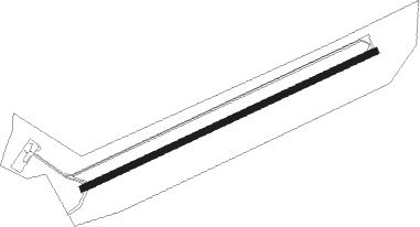
Remomeix - Saint Die Remomeix
Airport details
| Country | France |
| State | Grand Est |
| Region | LF |
| Airspace | Reims Ctr |
| Municipality | Remomeix |
| Elevation | 1184ft (361m) |
| Timezone | GMT +1 |
| Coordinates | 48.26639, 7.00750 |
| Magnetic var | |
| Type | land |
| Available since | X-Plane v10.40 |
| ICAO code | LFGY |
| IATA code | n/a |
| FAA code | n/a |
Communication
| Saint Die Remomeix CTAF | 123.500 |
| Saint Die Remomeix Twr | 123.500 |
| Saint Die Remomeix Dep | 123.500 |
Nearby Points of Interest:
Temple maçonnique de Saint-Dié-des-Vosges
-Usine Gantois
-Château de Saint-Dié-des-Vosges
-palais de la Galazière
-fontaine, place du Chapitre
-fontaine, 14 rue du Nord
-Cure de Saint-Dié
-Camp celtique de la Bure
-Maison Masson-Wald
-filature des Aulnes
-Tour des mineurs d'Echery
-Mount Neuenberg silver mines
-église Sainte-Madeleine de Sainte-Marie-aux-Mines
-Maison au 8, rue du Docteur-Weisgerber à Sainte-Marie-aux-Mines
-église des Chaînes (Sainte-Marie-aux-Mines)
-Temple réformé de Sainte-Marie-aux-Mines
-maison Blech
-châteaux des princes de Salm-Salm
-champ de bataille de la Tête-des-Faux
-Pierre d'Appel
-Château Burrus
-Pairis Abbey
-Mine Haus Österreich
-Chapelle du cimetière de Steige
-Alspach Priory
Nearby beacons
| code | identifier | dist | bearing | frequency |
|---|---|---|---|---|
| HO | COLMAR-HOUSSEN NDB | 16.4 | 110° | 380 |
| STR | STRASBOURG ENTZHEIM VOR/DME | 26.7 | 67° | 115.60 |
| PHG | PHALSBOURG NDB | 31 | 21° | 424 |
| LHR | LAHR NDB | 32.4 | 84° | 337 |
| EMT | EPINAL NDB | 32.7 | 275° | 419 |
| LRD | DME | 33.2 | 83° | 108.05 |
| SE | STRASBOURG NDB | 34.1 | 65° | 412 |
| SAV | SAVERNE VOR/DME | 36.3 | 40° | 110.45 |
| EPL | EPINAL MIRECOURT VOR | 38 | 273° | 113 |
| LXI | LUXEUIL SAINT SAUVEUR TACAN | 39 | 233° | 108.20 |
| BN | BASLE-MULHOUSE NDB | 40.9 | 142° | 353 |
| BLM | BASLE-MULHOUSE VOR/DME | 42.8 | 142° | 117.45 |
| HR | HERICOURT NDB | 43.7 | 201° | 289 |
| GTQ | GROSTENQUIN VOR/DME | 44.7 | 338° | 111.25 |
| LUL | LUXEUIL VOR | 44.9 | 231° | 117.10 |
| MB | MONTBELIARD NDB | 45.9 | 186° | 330 |
| BS | BASLE-MULHOUSE NDB | 46.4 | 142° | 376 |
| LOU | LORRAINE NDB | 52.7 | 315° | 388 |
| HOC | DME | 54.8 | 141° | 113.20 |
| SAD | DME | 56.9 | 7° | 116.75 |
| SR | ENSHEIM (SAARBRUECKEN) NDB | 57.7 | 13° | 360 |
| ZWN | ZWEIBRUECKEN VOR/DME | 60 | 23° | 114.80 |
| BSV | BESANCON NDB | 68.2 | 219° | 370 |
Disclaimer
The information on this website is not for real aviation. Use this data with the X-Plane flight simulator only! Data taken with kind consent from X-Plane 12 source code and data files. Content is subject to change without notice.
