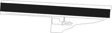
L'horme - Saint Chamond L' Horme
Airport details
| Country | France |
| State | Auvergne-Rhône-Alpes |
| Region | LF |
| Airspace | Marseille Ctr |
| Municipality | L'Horme |
| Elevation | 1293ft (394m) |
| Timezone | GMT +1 |
| Coordinates | 45.49194, 4.53444 |
| Magnetic var | |
| Type | land |
| Available since | X-Plane v10.40 |
| ICAO code | LFHG |
| IATA code | n/a |
| FAA code | n/a |
Communication
| Saint Chamond l' Horme CTAF | 123.500 |
Nearby Points of Interest:
Hôtel Subit-Gouyon
-Centrale électrique de Manufrance
-Hôtel de ville de Saint-Étienne
-Hôpital de La Charité
-Hôtel de Villeneuve
-Immeuble Moderne
-Immeuble - 15 rue Gambetta (Saint-Étienne)
-Palais Mimard
-Canal de Givors
-Tourbière de Gimel
-Thermes du Palais du Miroir
-Escaliers antiques de Vienne
-Villa Vaganay
-Moly-Sabata
-Pont de Moulin sur Cance
-Croix de Saint-Alban-d'Ay
-Gare du Bourbonnais
-Hospice Debrousse
-Sainte Marie de La Tourette
-Hôtel de Sarron
-Hôtel de Lacroix-Laval
-Antiquaille Hospital
-Garage Citroën
-Rhône's Pool
-Chapelle Saint-Thomas
Nearby beacons
| code | identifier | dist | bearing | frequency |
|---|---|---|---|---|
| BO | SAINT ETIENNE NDB | 10 | 277° | 299 |
| EB | SAINT ETIENNE NDB | 13.7 | 300° | 379 |
| VNE | VIENNE REVENTIN VOR | 15.1 | 80° | 108.20 |
| BR | LYON-BRON NDB | 20.6 | 75° | 388 |
| WS | GRENOBLE NDB | 27.2 | 102° | 291 |
| LSE | LYON SAINT EXUPERY VOR/DME | 27.8 | 65° | 114.75 |
| EG | GRENOBLE NDB | 37.1 | 98° | 397 |
| LTP | LA TOUR DU PIN VOR/DME | 38 | 90° | 115.55 |
| ROA | ROANNE VOR | 40.7 | 317° | 110.25 |
| PY | LE PUY NDB | 41.6 | 237° | 372 |
| VE | VALENCE NDB | 42.5 | 147° | 320 |
| RNN | ROANNE NDB | 42.6 | 321° | 358 |
| TIS | THIERS VOR/DME | 47.3 | 292° | 117.50 |
| SN | SAINT YAN NDB | 51.1 | 333° | 430 |
| MTL | MONTELIMAR ANCONE VOR/DME | 57.2 | 165° | 113.65 |
Disclaimer
The information on this website is not for real aviation. Use this data with the X-Plane flight simulator only! Data taken with kind consent from X-Plane 12 source code and data files. Content is subject to change without notice.