Verdun - Vouvray
Airport details
| Country | France |
| State | Auvergne-Rhône-Alpes |
| Region | LF |
| Airspace | Marseille Ctr |
| Municipality | Valserhône |
| Elevation | 1624ft (495m) |
| Timezone | GMT +1 |
| Coordinates | 46.12333, 5.80472 |
| Magnetic var | |
| Type | land |
| Available since | X-Plane v10.40 |
| ICAO code | LFHN |
| IATA code | n/a |
| FAA code | n/a |
Communication
| Vouvray ATC | 123.500 |
Nearby Points of Interest:
Town hall of Bellegarde-sur-Valserine
-Plateau de Retord
-Lac Genin
-Borne frontière de la Buna
-Allondon
-Gare de La Cluse
-Onex
-Museum of the Order of Malta
-Grotte de Corveissiat
-Moulin à farine de Cerdon
-Fonds cantonal d'art contemporain, Genève
-Carouge
-Archives communales de Carouge
-École Geisendorf, Genève
-Conservatoire de Musique de Genève
-place Neuve
-Geneva iconography centre
-old “Credit Lyonnais”
-Bibliothèque de Genève
-Archives de la ville de Genève
-Archives d'État de Genève
-Cintia Valeria Ramos
-Tavel House
-Pont de Serrières-sur-Ain
-Union Internationale des Télécommunications / Internationale Fernmeldeunion
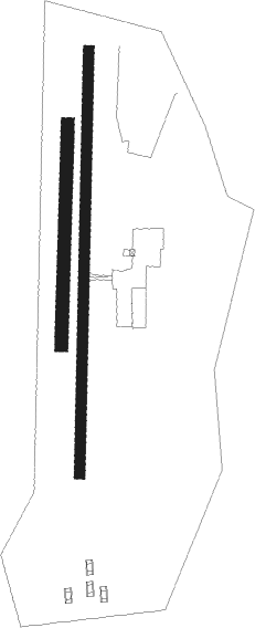
Runway info
Runway 01L / 19R  | ||
| length | 350m (1148ft) | |
| bearing | 9° / 189° | |
| width | 20m (66ft) | |
| surface | grass | |
| Runway 01 / 19 | ||
| length | 671m (2201ft) | |
| bearing | 8° / 188° | |
| width | 18m (59ft) | |
| surface | asphalt | |
| displ threshold | 0m (0ft) / 120m (394ft) | |
Nearby beacons
| code | identifier | dist | bearing | frequency |
|---|---|---|---|---|
| PAS | PASSEIRY VOR/DME | 8.4 | 78° | 116.60 |
| CBY | CHAMBERY VOR/DME | 14.6 | 191° | 115.40 |
| GVA | GENEVA VOR/DME | 15.7 | 68° | 115.75 |
| AT | ANNECY NDB | 18.1 | 141° | 384 |
| GLA | GLAND NDB | 25 | 57° | 375 |
| CH | CHAMBERY NDB | 32 | 172° | 346 |
| SPR | ST PREX VOR/DME | 33.8 | 62° | 113.90 |
| LSE | LYON SAINT EXUPERY VOR/DME | 37.4 | 242° | 114.75 |
| LTP | LA TOUR DU PIN VOR/DME | 41 | 210° | 115.55 |
| LAP | PRAZ DME | 41.6 | 48° | 110.65 |
| BR | LYON-BRON NDB | 45.6 | 238° | 388 |
| EG | GRENOBLE NDB | 48.7 | 208° | 397 |
| VNE | VIENNE REVENTIN VOR | 51.4 | 238° | 108.20 |
| WS | GRENOBLE NDB | 53.2 | 221° | 291 |
| CC | CHAMPFORGEUIL NDB | 53.6 | 302° | 391 |
| DO | DOLE NDB | 55.4 | 330° | 309 |
| LPS | LES EPLATURES NDB | 70.6 | 46° | 403 |
Disclaimer
The information on this website is not for real aviation. Use this data with the X-Plane flight simulator only! Data taken with kind consent from X-Plane 12 source code and data files. Content is subject to change without notice.