Chaspuzac - Le Puy Loudes
Airport details
| Country | France |
| State | Auvergne-Rhône-Alpes |
| Region | LF |
| Airspace | Marseille Ctr |
| Municipality | Loudes |
| Elevation | 2729ft (832m) |
| Timezone | GMT +1 |
| Coordinates | 45.07965, 3.76344 |
| Magnetic var | |
| Type | land |
| Available since | X-Plane v10.40 |
| ICAO code | LFHP |
| IATA code | LPY |
| FAA code | n/a |
Communication
| Le Puy Loudes LE PUY INFO | 118.000 |
Nearby Points of Interest:
hôpital général du Puy-en-Velay
-b&b de la prevote
-hôtel de Saint-Vidal
-Gorges de l'Allier
-Ravines of Corbœuf
-Pont de Lavoûte-Chilhac
-Croix de Briges
-Halles de Langogne
-Filature des Calquières
-Couvent des Ursulines du Malzieu-Ville
-Chapelle de Roc-Saint-Pierre
-Église Saint-Romain de Mars
-Croix des Anglais
-Château de Varillettes
-Statue of Lichessol
-Croix de Serverette
-Église Saint-André de Saint-André-en-Vivarais
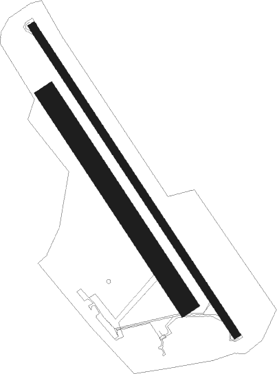
Runway info
Runway 15 / 33  | ||
| length | 1394m (4573ft) | |
| bearing | 142° / 322° | |
| width | 30m (98ft) | |
| surface | asphalt | |
| blast zone | 30m (98ft) / 0m (0ft) | |
| Runway 15R / 33L | ||
| length | 941m (3087ft) | |
| bearing | 142° / 322° | |
| width | 80m (262ft) | |
| surface | grass | |
| displ threshold | 0m (0ft) / 155m (509ft) | |
Nearby beacons
| code | identifier | dist | bearing | frequency |
|---|---|---|---|---|
| PY | LE PUY NDB | 4.2 | 140° | 372 |
| BO | SAINT ETIENNE NDB | 34.8 | 51° | 299 |
| MEN | MENDE VOR/DME | 38.1 | 232° | 115.30 |
| EB | SAINT ETIENNE NDB | 40 | 43° | 379 |
| ASM | CLERMONT-FERRAND/AUVERGNE NDB | 46.7 | 331° | 367 |
| CFA | CLERMONT FERRAND AUVERGNE VOR/DME | 48.8 | 321° | 114.35 |
| TIS | THIERS VOR/DME | 48.9 | 345° | 117.50 |
| ROA | ROANNE VOR | 59.6 | 14° | 110.25 |
Instrument approach procedures
| runway | airway (heading) | route (dist, bearing) |
|---|---|---|
| RW15 | LAPUB (142°) | LAPUB 5600ft FHP15 (5mi, 142°) 5400ft |
| RNAV | FHP15 5400ft LFHP (8mi, 142°) 2757ft HP520 (3mi, 142°) HP522 (10mi, 13°) HP524 (8mi, 322°) LAPUB (6mi, 249°) 5600ft LAPUB (turn) 5600ft | |
| RW33 | ERUDO (296°) | ERUDO 6400ft IHP33 (6mi, 249°) 6100ft |
| RW33 | LEKSO (273°) | LEKSO ERUDO (7mi, 168°) 6400ft IHP33 (6mi, 249°) 6100ft |
| RW33 | URUXI (356°) | URUXI IHP33 (6mi, 69°) 6100ft |
| RNAV | IHP33 6100ft FHP33 (5mi, 322°) 5300ft LFHP (7mi, 322°) 2777ft HP410 (4mi, 322°) LEKSO (13mi, 105°) 6400ft LEKSO (turn) |
Disclaimer
The information on this website is not for real aviation. Use this data with the X-Plane flight simulator only! Data taken with kind consent from X-Plane 12 source code and data files. Content is subject to change without notice.