Loudervielle - Peyresourde Balestas
Airport details
| Country | France |
| State | Occitania |
| Region | LF |
| Airspace | Bordeaux Ctr |
| Municipality | Loudervielle |
| Elevation | 5144ft (1568m) |
| Timezone | GMT +1 |
| Coordinates | 42.79636, 0.43929 |
| Magnetic var | |
| Type | land |
| Available since | X-Plane v10.40 |
| ICAO code | LFIP |
| IATA code | n/a |
| FAA code | n/a |
Communication
Nearby Points of Interest:
église de l'Invention-de-Saint-Étienne de Germ
-église Sainte-Marie-Madeleine (Loudervielle)
-Église Saint-Just-et-Saint-Pasteur de Loudenvielle
-Église Saint-Martin d'Aranvielle
-église Saint-Pierre d'Estarvielle
-église Saint-Jacques de Camors
-Église Notre-Dame d'Anéran
-Tour à signaux de Castet
-église Saint-Michel d'Estensan
-église Sainte-Luce-Saint-Vincent de Camparan
-Tour de Mayrègne
-église Notre-Dame de Gouaux
-Chapelle Saint-Jacques
-église Saint-Blaise de Ris
-église Saint-Just-et-Saint-Pasteur de Grézian
-église Saint-Saturnin de Cazaux-Debat
-Église Notre-Dame-de-l'Assomption de Bareilles
-Église Saint-Vincent de Pouy
-église Saint-Martin d'Is
-Chalets Spont
-église Saint-Félix (Cadéac)
-Résidence villa Luisa
-Casino of Bagnères-de-Luchon
-Villa Édouard
-église Saint-Étienne de Pailhac
Runway info
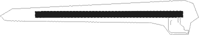
| Runway 09 / 27 | ||
| length | 461m (1512ft) | |
| bearing | 93° / 273° | |
| width | 20m (66ft) | |
| surface | concrete | |
Nearby beacons
| code | identifier | dist | bearing | frequency |
|---|---|---|---|---|
| TL | TARBES NDB | 34.1 | 322° | 321 |
| TBO | TARBES VOR/DME | 34.6 | 331° | 113.90 |
| PO | PAU/PYRENEES NDB | 40.9 | 311° | 397 |
| LMB | LEMBEYE VOR | 44.9 | 326° | 111.80 |
| PU | PAU/PYRENEES NDB | 45.3 | 305° | 364 |
| TW | TOULOUSE NDB | 51 | 39° | 406 |
| MUT | MURET NDB | 52.3 | 47° | 350 |
| HUE | HUESCA VOR/DME | 54.9 | 226° | 114.55 |
| LMT | AUCH NDB | 55.7 | 10° | 420 |
| TLF | FRANCAZAL NDB | 58.7 | 44° | 332 |
| TOU | TOULOUSE BLAGNAC VOR/DME | 65.3 | 45° | 117.70 |
| TON | TORRALBA DE ARAGON NDB | 67.1 | 228° | 335 |
Disclaimer
The information on this website is not for real aviation. Use this data with the X-Plane flight simulator only! Data taken with kind consent from X-Plane 12 source code and data files. Content is subject to change without notice.