Moulins - Revel Montgey
Airport details
| Country | France |
| State | Occitania |
| Region | LF |
| Airspace | Bordeaux Ctr |
| Municipality | Revel |
| Elevation | 643ft (196m) |
| Timezone | GMT +1 |
| Coordinates | 43.48028, 1.97889 |
| Magnetic var | |
| Type | land |
| Available since | X-Plane v10.40 |
| ICAO code | LFIR |
| IATA code | n/a |
| FAA code | n/a |
Communication
| Revel Montgey INFO | 119.575 |
Nearby Points of Interest:
Église Sainte-Agathe-et-Saint-Julien de Saint-Julia
-château d'Aguts
-Château de Saint-Félix-Lauragais
-Halle de Saint-Félix-Lauragais
-Centre national de vol à voile de la Montagne Noire
-Montauban-Puylaurens Academy
-Château de Cambiac
-Croix de cimetière d'Airoux
-Couvent des Carmes de Castelnaudary
-hôtel de Bataille
-Hôtel de Gauzy
-maison Rigaud
-château de Castelnaudary
-Maison éclusière de Laurens de Mas-Saintes-Puelles
-tour d'Avignonet-Lauragais
-Maison Nicol
-Remparts de Saissac
-Domaine de la Fédial
-chaussée de Coudières
-tower of Navès
-Halle de Labruguière
-Hôtel Leroy
-Hôtel Poncet
-Maison, 31 rue de l'Hôtel-de-Ville
-Écluse de Gardouch
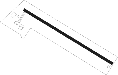
Runway info
| Runway 13 / 31 | ||
| length | 748m (2454ft) | |
| bearing | 118° / 298° | |
| width | 18m (59ft) | |
| surface | asphalt | |
| displ threshold | 110m (361ft) / 0m (0ft) | |
Nearby beacons
| code | identifier | dist | bearing | frequency |
|---|---|---|---|---|
| TOE | TOULOUSE NDB | 13 | 270° | 415 |
| CVU | CASTRES-MAZAMET NDB | 13.5 | 57° | 356 |
| CS | CARCASSONNE SALVAZA NDB | 18.4 | 138° | 345 |
| TS | TOULOUSE NDB | 21.5 | 273° | 423 |
| AB | ALBI NDB | 26.2 | 11° | 323 |
| PMR | PAMIERS NDB | 28.6 | 225° | 384 |
| GAI | GAILLAC VOR | 29.2 | 342° | 115.80 |
| TOU | TOULOUSE BLAGNAC VOR/DME | 31.5 | 287° | 117.70 |
| TLF | FRANCAZAL NDB | 34.1 | 279° | 332 |
| MUT | MURET NDB | 34.7 | 270° | 350 |
| TLB | TOULOUSE NDB | 36.4 | 311° | 368 |
| TW | TOULOUSE NDB | 41.6 | 273° | 406 |
| ROM | RODEZ NDB | 57.9 | 36° | 302 |
| PPG | PERPIGNAN RIVESALTES VOR/DME | 58.7 | 129° | 117.20 |
| CL | CAHORS NDB | 59.5 | 328° | 348 |
| RZ | RODEZ NDB | 60.4 | 26° | 387 |
| PL | RIVESALTES (PERPIGNAN) NDB | 63.5 | 130° | 351 |
Disclaimer
The information on this website is not for real aviation. Use this data with the X-Plane flight simulator only! Data taken with kind consent from X-Plane 12 source code and data files. Content is subject to change without notice.